Wednesday, August 17, 2016

CAPE BRETON - CABOT TRAIL & LOUISBOURG FORTRESS - August 6 to 8, 2016

The Cabot Trail is a 298 kilometre scenic roadway loop in northern Cape Breton passing along and through the Cape Breton Highlands National Park. It is of course named after explorer John Cabot who landed in Atlantic Canada in 1497. Most historians believe his first landfall was likely in Newfoundland and not Cape Breton Island, although Premier Angus L. MacDonald attempted to re-brand Nova Scotia for tourism purposes, as primarily Scottish. As part of this effort he created both the names Cape Breton Highlands and Cabot Trail  and construction of the initial route was completed inn 1932.

While in St. Peters, our group managed to rent two vehicles for two days of touring Cape Breton island. Day one was devoted to the Cabot Trail. We packed a lunch and also an overnight bag in case we found a motel or Bed and Breakfast with a vacancy, as the driving distances from St. Peters are rather long.

En route to the Cabot Trail we stopped in the Dingwall area for lunch and then had a guided tour of the St Paul Island Museum and Lighthouse. Nova Scotia has more lighthouses than any other province in Canada with ~ 150 at the present time. St Paul Island, 13 nautical miles off the northeast coast of Cape Breton Island, is locally known as the graveyard of the Gulf of St. Lawrence, with over 350 shipwrecks occurring there over the last 400  years. Because of the extreme danger to shipping through the Gulf of St. Lawrence to Quebec City, the British government decided to build two wooden lighthouses on St. Paul Island. The first southwest light was built in 1839, but was destroyed by fire in 1916. A cast iron replacement (the first in Canada) was prefabricated in sections in Ontario in 1915 and shipped to Cape Breton by train. It took two years to transport the sections to Cape Breton and move them to St Paul Island by boat and then bolt the sections together. This lighthouse was replaced in 1982 by an automated one and the cast iron lighthouse now sits in Dingwall at the St Paul Island Museum.

St Paul Island Museum & Lighthouse

The museum and lighthouse are a tribute to the light keepers and their families. From the photos and artifacts at the museum, it is hard to imagine a more remote and isolated existence. However, we were told folks lined up to apply for the job. Those who were married were given priority as it meant there was a backup light keeper (the wife) if the husband fell ill or died. These dedicated souls helped keep the lights burning and shipping safer, at considerable hardship for many years. Automation of course ended these careers but their story is forever linked to Canada’s early history.


The Cabot Trail and the Cape Breton Highland National Park are simply spectacular. The forests are endless. The switchback roadway climbs to high peaks with magnificent shoreline and ocean vistas. We passed many very fit cyclists loaded down with gear for their long and challenging tour of the Cabot Trail. We also passed many less fit folk on motorcycles enjoying the ride on the lovely winding roadway. Later in the afternoon we stopped for a great early dinner at the Rusty Anchor Restaurant along the northwest shore of Cape Breton for a feed of Crab Cakes and Sole Fish N Chips. We wisely heeded advice to do the Cabot Trail drive in a counter clockwise direction so most of the time we’d be pulling off to the right hand side of the road (and back on again) at the countless “lookouts” we stopped at for yet another photo. Despite our best efforts, we found no motel or B&B vacancies.It was a lovely day and we were blessed with perfect weather for this drive, but we were well worn out as we didn’t get back to our boats until just before dark.

Photos of Cabot Trail


Sunday August 7, 2016
Day 2 of our car rental took us back up to Cape Breton’s northeast shoreline to see the Fortress of Louisbourg. This 18th century French fortress is a National Historic Site and its also been designated a Unesco World Heritage Site. The original settlement was made in 1713 as a fishing port and it grew to become a major commercial port and a strongly defended fortress. Fortified walls eventually surrounded the town and by the mid 1740’s Louisbourg was one of the most extensive and expensive European fortifications constructed in North America. 

Louisbourg suffered several key weaknesses. It was erected on low lying ground with low-lying hills around it and all its defences were directed toward sea-based assaults leaving land-based defences rather weak. Secondly, it was a very long way from France or Quebec from where reinforcements might be sent. As a result, Louisbourg was captured by the British in 1745 and it became a key bargaining chip in the negotiations leading to the 1748 treaty ending the War of the Austrian Succession. Louisbourg was returned to France in exchange for border towns in what is now Belgium. It was captured again by the British in 1758 in the Seven Years War after which its fortifications were systematically destroyed. 

Starting in 1961 and throughout the 1960’s and 70’s, the Canadian Federal Government undertook a historical reconstruction of one quarter of the town and fortifications with the aim of recreating Louisbourg as it would have been at its height in the 1740’s. Unemployed coal miners were trained in French masonry techniques from the 18th century and other skills to create an accurate replica from drawings found in France. The work required interdisciplinary efforts by archaeologists, historians, engineers and architects. Today the site is run by Parks Canada and the fortress is staffed by locals in period costume helping visitors understand the history and what life was like in the 1740’s. It is an absolutely fascinating experience helping one gain insight Louisbourg’s importance in shaping Canada’s early history.


At the end of the day, after returning our rented cars, Jan (off of Wings) hosted a dinner in the marina clubhouse to celebrate Bob’s birthday. What a wonderful end of another perfect day on our Down East Circle Route adventure.

Pictures of Fortress of Louisbourg


Lunch, 18th Century style


Boatbuilding at Fortress of Louisbourg


Lighthouse Point, Louisbourg


35' Wings dwarfed by 90' Burger Yacht at St. Peters


Monday, August 8, 2016

CRUISING IN SALT WATER - MERIGOMISH HARBOUR, BALLANTYNES COVE, HAVRE BOUCHER, HADDOCK HARBOUR & ST PETERS - AUGUST 1 - 5, 2016


Here is the route covered by this blog posting.


We chose to a picture perfect day for our crossing the Northumberland Strait from Charlottetown PEI to an anchorage at Merigomish Harbour in Nova Scotia. This will be our 5th province on our summer adventure. The sky was brilliantly clear and we had a 10 knot breeze from the west north west. However, we were headed south south east, so the 3’ waves (occasional 4’ waves) were on our stern corner making for a corkscrew sort of ride that got a little uncomfortable. 

Today, we have three of our four boats (Tug’n, Sir Tugley Blue and Encore), three Nordic Tugs. Wings stayed behind for a few days in Charlottetown so Bob could go home for a short visit with one of his daughters who was gravely ill with MS. They will catch up with us in Cape Breton. 

Our 48 mile crossing took us about 6 1/2 hours and thankfully for the last few hours the waves calmed down providing a much more comfortable ride. We made our way all the way back in Merigomish Harbour to a lovely, well protected anchorage called Blackhall Gut. Almost as soon as we all had our anchor down and engine shut off, there began a parade of local boats into the bay to inspect our boats and wish us a hearty “Welcome to Nova Scotia. Where have you come from? Where are you headed? How long are you out for? Etc Etc”. It was as if word spread all around the local community and everyone came out to see us. It was really quite a special welcome. We had happy hour aboard Encore to plan our next day and then Fran & I enjoyed an exquisite dinner of grilled scallops followed by quiet evening with a spectacular sunset.

Lighthouse at Cape George


Sunset at Merigomish Harbour


Monday August 1st
Mother Nature has been very kind to us and we are really appreciating the fantastic weather. An early morning mist cleared quickly as the warm summer sun rose. When we got underway a lovely ebb tide helped to push us along. The cruise through calm water this morning was quite uplifting with sightings of minke whales and porpoises. Today’s cruise was broken into two sections. The first was to take us out around the tip of Cape George and into the tiny village of Ballantynes Cove in Antigonish County, Nova Scotia. The community and cove are named after David Ballantyne, a lowland Scotsman and British soldier who served in the 82nd regiment during the American Revolution and who received a land grant for his military service. He settled in the area in 1810. 

Ballantynes Cove shelters a Small Craft Harbour and it is a principal trading point for Japanese merchants looking for sushi-grade Atlantic bluefin tuna. The harbour hosts Ballantynes Cove Tuna Interpretive Centre, which was the prime purpose of our stop. The harbour was small and required Encore to raft with a fishing boat and Sir Tugley and Tug’n to raft together in another spot. At the Tuna Centre we learned:

  • There are a fixed number of licences issued and they are for life. The current price of a licence is about $30,000. A licence allows the owner to catch one Bluefin Tuna per year. Licences rarely trade owners and most often stay in the same family
  • Tuna range in size from about 300 pounds up to almost 1500 pounds. The largest on record is  1496 pounds caught in Nova Scotia in 1979. The season starts on August 5th each year and runs to November. Most fishermen wait until the early fall as to start trying to catch their one tuna as the tuna are in these waters to feed and they gain about 2 kilos per day.
  • Before a licence holder heads out to fish for his tuna, he must fill in and submit a series of forms. If he’s successful, he must call in his catch and his vessel will be met by the Harbour Authority to accept the catch, weigh it and prepare it for auction the next day
  • Tuna are the worlds most sought after sport fishing catch - it is a “catch and release program”  in Canada
  • Tuna are very fast swimmers, reaching up to 50 miles per hour
  • The young lady who guided us through the Tuna Interpretative Centre is a member of a fishing family, who is training to take over her father’s lobster licence in about 5 years. 
Cape George


Bluefin Tuna Interpretive Center (Dave, Barb & Fran)


Model of 300 pound Bluefin Tuna


Tug'n, Sir Tugley & Encore at Ballantyne Cove


An hour and a half later, we were underway again, headed for an anchorage at Havre Boucher, close to Strait of Canso. True to predictions in our cruising guide, our crossing of St. Georges Bay was much windier than expected as the ocean wind is funnelled down between the Cape George Peninsula and Cape Breton Island. The waves kept growing until they were 4’ plus from the stern corner making for a very uncomfortable ride. It was a relief to get into the anchorage at Havre Boucher so we could relax. Havre Boucher is a small village that relies on fishing as well as providing services to the surrounding rural communities. For us, it provided protection from waves and an easy access for entrance to the Strait of Canso tomorrow. Once again we were treated to another great sunset.

Sunset at Havre Boucher Harbour


Tuesday August 2nd. 
The Strait of Canso is the narrow strip of water that divides Cape Breton from Nova Scotia. Canso Causeway is a rock-fill causeway that crosses the Strait of Canso. It is 40 meters wide and 1,385 meters long and it carries a two lane road of the Trans Canada Highway and a single rail line to Cape Breton. The base of the causeway is 244 meters wide and it reaches a maximum depth of 65 meters. Cape Breton remains a true island as the causeway has a 250 meter by 24 meter lock / canal and a swing bridge for vehicles and trains. Construction started in September 1952 and was completed December 10, 1955. 

Tidal waters produced very strong currents through the strait making it difficult for commercial vessels to transit it. Construction of the causeway completely stopped the tide through the straight making it possible for ships to pass through the straight via a control lock. However, the causeway caused some significant environmental damage due to the enormous change in the tidal regime of the southern Gulf of St. Lawrence all the way to the mouth of the St. Lawrence River. The causeway effectively dammed the waterway for migrating ground fish stocks and it took decades until some of these species were able to determine how to get around Cape Breton Island and into the Gulf. The causeway also allowed several non-native animals to gain access onto Cape Breton. For instance, bobcats migrated onto the island, slowly forcing the more gentle lynx out of its traditional hunting grounds. The causeway also dramatically affected lobster fishery with much smaller catches recorded ever since its construction.

Our transit through the Canso lock was very smooth and soon we were motoring along through the 27 kilometre long Canso Straight and from there on to Lennox Passage. Our cruising guide directed us into Haddock Harbour where we selected the best anchorage based on the wind forecast.

After lunch, we began a relatively new ritual for us. It all has to do with “cruising in salt water”. So, what’s the big deal with salt water? Before embarking on this trip, I’d managed to build up this impression in my mind that salt is the enemy! It will rust any unprotected metal. It will penetrate the inside of your boat over time, causing various metals on the inside to get pitted with corrosion. Basically if you let it, salt will eat away at everything. So, this was one aspect of the trip I was dreading. Here is what we’ve learned:
  • When out on the water, spray from the wind and waves will cover your boat. As the salt water dries it leaves salt crystals everywhere. You can wipe you hand along a stainless steel rail and get your fingers covered in salt crystals
  • We have scuppers in the cockpit of our boat to drain water away. If the water is rough while underway, water from waves will splash up the scupper into our cockpit. We mostly walk barefoot around our boat, but stepping onto a deck that is damp with salt water doesn’t feel very good and you will track it back inside the boat onto your floors and carpets
  • On the positive side, there are far fewer bugs (mosquitos, deer flies, horse flies etc) in a salt water environment. Also, the boat floats higher and goes faster and somewhat more efficiently in salt water vs fresh water. Salt water has tides and currents, so if you plan your trips carefully, you can move faster and use less fuel which is also great. We’ve learned to love tides, sort of. 

So, with all this new knowledge, the largest impact on our lives is the ritual of boat cleaning. After most daily travel, when at a dock or an anchorage, we dig out the hose and rinse the boat off and wipe it down. Just rinsing alone does not clean the salt off and the boat will still be a mess. We’ve learned you can do a much better job with a pail of hot water and a brush to do the initial light scrub, followed by a fresh water rinse with the hose, followed by a wipe with shammies and/or micro fibre cloths. It is a lot of work, but we are bound and determined to keep the boat looking good and keep the rust away. So far, so good. 

Later, we and the crew of Encore did a dinghy excursion to explore the anchorage before happy hour aboard Sir Tugley Blue. This was followed by another peaceful evening at anchor. We love to anchor!

Sunset at Haddock Harbour


Wednesday August 3rd:
This morning, Encore and Sir Tugley headed off for St Peters on Cape Breton. We stayed behind thinking we’d wait for Bob and Jan on Wings. I spent the morning giving the hull a good wash to eliminate layers of salt crystals. It was the hot water & brush, rinse with the hose and the wipe down. As you'll see from the “before and after” photos, it is very rewarding work. Later we had a phone call with Wings and decided we’d also head for St Peters and meet them there. While our anchorage was calm and I had hopes the boat would stay relatively salt free today, I was woefully optimistic. As we approached St Peters Bay, the wind picked up to 18 knots and we were taking regular spray over the bow, guaranteeing Tug’n another wash later in the day. Grrrrrrrrr.

Entering St. Peters was interesting. There is a man made, small shipping canal and lock that joins the Atlantic Ocean and St Peters Bay to the Bras d’Or Lakes in the interior of Cape Bretton Island. There is also a northern entrance to the Bras d’Or Lakes that opens to the Laurentian Channel and the Atlantic. Unlike most other channels whose water flow is in one direction, water in the St Peters channel flows both directions. Water on both sides of the St Peters Canal are tidal and timing differences mean one side or the other can be the “high side”. As a result, both ends of the lock have double gates allowing either end of the lock to be the high water side. It is the only lock of its kind in North America. Prior to construction of St Peters Canal and lock, a “haulover road” was established to portage smaller vessels from St Peters Bay into the Bras d’Or Lakes and back.The canal and lock were completed in 1869. Various additions and renovations were completed up until 1917 when the canal became too small for modern ships and since then it has primarily been used by pleasure boats. 

It was a great experience to transit this historic lock. A short distance after the lock, we arrived at St Peters Lions Club Marina. We’ve never stayed at a marina owned by a service club and it sure turned out to be a great treat. The marina has been run by a manager named Gerry, who has run it since the Lions Club of St Peters acquired it 26 years go. It is just about the friendliest marina you could wish to visit. A day later, Bob and Jan on Wings caught up with us. 

On Thursday Aug 4th, we celebrated Dave’s birthday (Sir Tugley Blue). Conveniently, the Lions Club had a fund raiser and were selling chowder dinners complete with a bowl of chowder, a roll & butter and a strawberry shortcake dessert. The Lions Club hall was full, so we had a “take away” dinner and all 8 of us sat around a table in the Marina club house and dined on the best seafood chowder we’ve had all summer. Who knew that a Lions Club would serve up the best chowder, but really, it was the very best. It was absolutely loaded with all sorts of seafood including a very generous amount of lobster. Everyone raved about it. I’ll go out on a limb here and say we are not likely to find a better chowder anywhere. 


Friday August 5th was spent organizing rental cars for the 8 of us, planning two days of excursions on the island and grocery shopping. We also had a surprise visit by boating friends Tim and Bice whom we normally see in Lake Huron’s North Channel. They were on a road trip to the east coast and we had a lovely, but short visit with them aboard Tug’n.

Salt spray dried on the hull


Same section of hull after cleaning the salt


Tug'n (left side) dwarfed by 68' Nordhavn (right) at
St. Peters Lions Club Marina


Sunday, July 31, 2016

BOUCTOUCHE, SUMMERSIDE & CHARLOTTETOWN - July 23 - 30, 2016


Here is our route covered by this blog. The map, lines
and labels are from our brother in law Manny from
the Philippines (thanks Manny)


After that thunderstorm and high winds on Bay du Vin, near Miramichi, we had a bad night of wave slapping on the hull and were up at 0530 feeling rather worn out, but eager to get underway to our next destination, Bouctouche (pronounced - Buck-too-shhh), New Brunswick. It was a long, 67 mile run, but we were looking forward to meeting up with Dave and Judy from Sir Tugley Blue, whom we’d been separated from since June 21st. For us, the run out to Point Escuminac and south to Bouctouche was a very smooth one, but for Sir Tugley Blue, the first half of their run from Shippigan to Bouctouche was much rougher and uncomfortable. 

Bouctouche is a small village of 2,400 on the Bouctouche River. The name comes from the Mi’Kmaq word meaning “Great Little Harbour”. It was first settled by Acadians in 1785 and in the 19th century by Irish and Scottish immigrants. Today, 89% of the population are French speaking. Bouctouche is best known for its shoreline sand dunes formed by centuries of wind and stormy seas. The sand dunes have almost closed off the entrance to the bay, which is now 1.8 kilometres wide and still shrinking. 

Today, New Brunswick and the Irving family go hand in glove. Kenneth Colin Irving (Mar 14, 1899 - Dec 13, 1992) was one of Canada’s foremost entrepreneurs of the 20th century and was ranked as one of the world’s leading industrialists. K. C. Irving’s businesses began with a family sawmill in Bouctouche, NB.The Irving conglomerate of private companies now includes shipyards, oil exploration, refining and retailing, various food processing operations, media, hardware, building supplies, transportation, engineering and construction companies and more. All these companies are vertically integrated with each Irving company purchasing the services of other Irving companies keeping the profits wholly within the conglomerate. 

Reportedly, a majority of New Brunswicker’s work either directly or indirectly for the Irving family. The Irving family have almost a complete monopoly in print media in New Brunswick. Their level of influence is of potential concern, but on the plus side, they have invested considerable funds into environmental controls and alternative energy for its operations. The Irving family and all their companies are actively supporting Canada’s ratification of goals to reduce the country’s carbon footprint. In the 2011 list of Canadians by net worth, the combined Irving family ranked third in Canada at $8.07 billion. 

K. C. Irving and his wife were first buried in Bermuda. Later, in 2004, their bodies were exhumed and moved to the Scottish-style chapel built on the Jean Irving Plantation in Bouctouche, NB. This chapel is modelled after one in Scotland and master craftsmen were brought in to construct it. As the photos below show, it is a stunningly beautiful structure completed with great care and skill. The Jean Irving Plantation was created under the direction of Jean Irving over a 35 year period. It has over 5,000 trees, all indigenous to New Brunswick. The plantation also includes an Elizabethan garden, ponds, picnic tables, benches and walking paths for visitors to wander and enjoy the setting.

Beautiful Chapel built by Irving family


Chapel interior - ceiling like the inside of
a wooden ship


The Irving family have also taken a special interest in preserving the Bouctouche sand dunes so future generations may enjoy this special area. They installed boardwalks through the dunes so visitors can enjoy them without damaging the delicate marram grass that protects the dunes from erosion. They also installed an interpretation centre (Irving Eco Centre) for visitors to learn about the dunes history and the over 2,000 year time frame it took for their evolution into the present state. We took a walk along the lovely board walk and also walked the beach barefoot, enjoying wading in the fairly warm waters of Northumberland Straight. Later, we visited Le Pays De La Sagouine, a reproduction of a prohibition-era fishing village where you can discover Acadian culture through a group of unique characters, theatre, music, comedy, dance and cuisine on a small island in the town of Bouctouche. We enjoyed some lively music and dinner there, as the sun set. A perfect end to a great day.

Bouctouche sand dunes, boardwalk and beach


Fran & Stephen on boardwalk over dunes


Le Pays De La Sagouine (Acadian village)


Monday, July 25, 2016. Another week, another province. Today, we headed off to Prince Edward Island, crossing the famous Northumberland Straight. Again, we were blessed with good weather and had a smooth ~ 42 mile crossing, tying up at Silver Fox Yacht Club in Summerside, PEI. After getting settled, we headed off for an evening performance at the College of Piping & Celtic Performing Arts of Canada. The show was called “Highland Storm” where we were entertained by a wide range of Celtic music (bagpipes, guitar, drums, harp and more) and dance (both traditional and more modern highland dancing), performed by faculty, students and alumni. During intermission, we dined on strawberry shortcake with whipped cream, a favourite of mine - mmmmmmm!!!! All in all, it was a real treat and a great introduction to PEI.

Pipers & drummers in "Highland Storm" performance


Over the next two days, our crews of four boats rented two vehicles and we toured as much of the PEI countryside as we could. On Tuesday July 26th, we toured much of the North Coastal Route all the way out to North Cape and back, in a large circle. Everywhere we went, the homes, properties and farms were all impressively well maintained, neat and tidy. Every second farm seemed to have a lobster boat up on blocks after the conclusion of the recent fishing season, cleaned up and ready for 2017. We toured Mount Carmel Catholic Church, bought fresh cod from a fishery on the north west coast, saw the wind farm on the North Cape, had a seafood lunch (Lightkeeper’s Platter) at the Wind & Reef Seafood Restaurant, had beers at the West Point Harbour “The Catch Kitchen & Bar” and more… The photo of our Lightkeeper’s platter includes: two bowls of chowder, one lobster, raw oysters, scallops, shrimp, haddock, 2 pounds of mussels, Caesar salad, green & yellow beans & carrots and rice. It was awesome!

Lobster boat on blocks for the winter


Commercial harbour - lobster traps all stored for next year


Fran & Judy with a local fisherman


Mmmm - fresh oysters


Lightkeeper's Platter - wow, what a meal we shared


North Cape red cliffs & windmill farm


On Wednesday July 27th, we covered a fair part of the Central Coastal Drive in PEI. We enjoyed
  • more rolling countryside
  • many small villages and towns
  • several small commercial harbours with anywhere from 4 to 20 lobster boats
  • a light lunch at New Glasgow’s PEI Preserves Restaurant, which included scones and local jams
  • a walk through the beautiful, pastoral Garden of Hope next to the restaurant 
  • walked around Victoria by the Sea, a lovely village on Northumberland Straight
  • and much, much more
One of many beautiful churches we saw


Potatoes, potatoes everywhere!


Scenic small commercial harbour with farms in the
background


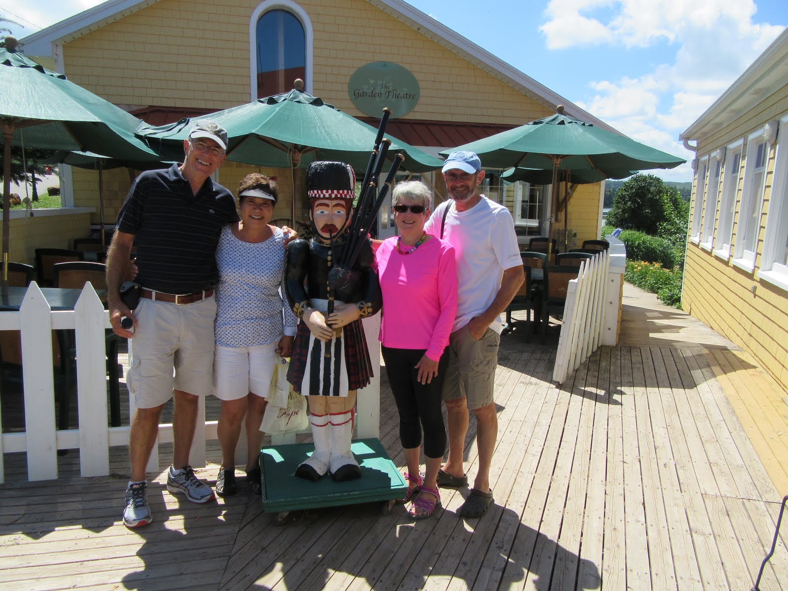
Stephen, Fran, Judy & Dave with a local piper


The crew of 4 boats having coffee in Victoria by the Sea

On Thursday, July 28th, we departed Summerland for Charlottetown, the Capital of PEI. Prince Edward Island is Canada’s smallest province of only 5,660 square kilometres and a population of approximately 147,000. It has a special place in Canada’s history as it is called “the Birthplace of Confederation”. Back in 1864, Charlottetown hosted the “Charlottetown Conference” where the maritime colonies of Nova Scotia, New Brunswick, Newfoundland and PEI were to discuss a maritime union at the urging of Britain, so they could become more economically independent from Britain (cost Britain less) and have greater military power for the region in the hopes of preventing any military intervention from America. The Province of Canada (comprising today’s Ontario & Quebec) heard about the planned conference and asked to join in and expand the agenda to discuss a union that would also include them. In September 1864 the conference was held and the delegates from all these regions (both government & opposition representatives) had lengthy meetings and social gatherings and in the end, they reached a level of understanding that created sufficient momentum that by July 1, 1867 the Dominion of Canada was formed. Initially, it included only four provinces (Ontario, Quebec, Nova Scotia and New Brunswick) with the remaining six provinces and three territories joining at later dates. 

Prince Edward Island joined Canada as a province in 1873 after negotiating a Federal Government commitment to provide “…efficient steam service for conveyance of mail and passengers between the island and mainland, winter and summer…”. 

Today, we were very excited to travel by boat from Summerside to Charlottetown as we’d have the opportunity to pass underneath the Confederation Bridge. While PEI enjoyed various forms of ferry service to and from the mainland with growing federal subsidies over the decades, the cost kept growing, prompting regular discussions about building a fixed link to the island. Finally, a proposal in the mid 1980’s resulted in the current bridge being built. However, there were conflicting views in PEI about the project resulting in court challenges, lengthy environmental impact studies and concerns from “Friends of the Island” who felt the fixed link would forever change the unique character of the island for the worse. A constitutional amendment was also required to deal with the change in service from ferry to bridge and the charging of tolls. 

Construction of the bridge took place from 1993 to 1997. All components of the bridge were built in purpose built staging yards at Amherst Head, New Brunswick including pier bases, ice shields, main spans and drop-in spans. Extra durable concrete and rebar was used in all the pre-cast components and the bridge was designed to last over 100 years. A Dutch built, heavy lift catamaran was rented to move the bridge components out into Northumberland Straight and put each one in place. The project required over 5,000 workers including engineers, surveyors and managers. 

The two lane toll bridge is 12.9 kilometres long and cost $1.3 billion. The multi-span beam bridge with post-tensioned concrete box girders has 44 main piers, each 250 meters apart and 18 smaller piers. It has a speed limit of 80 kilometres per hour. A car toll is $46 in 2016 for the round trip. Pre opening of the bridge, there were about 740,000 visitors to the island per year. In 1997, the year it opened, there were 1,200,000 visitors, but this has dropped back to 900,000 visitors per year. The number of overnight guests visiting the island has dropped as more people can now make day trips to PEI. Agricultural exports from the island increased significantly after the bridge opened. Big box stores have opened on the island providing more retail products to residents than ever before, but inevitably, it resulted in closing of many family owned retail outlets. 


Passing under the bridge was a huge thrill. It is a massive and beautiful structure and our pictures do not do justice to the marvel of the engineering of this bridge. 

Passing under Confederation Bridge (an engineering marvel)

After arriving in Charlottetown, we were picked up by a university friend of Stephen and had a wonderful reunion at the home of Ron, Hillis and their daughter Heather. Stephen had last seen them in about 1986 and Fran had never met them. We had the most wonderful time together reminiscing about previous adventures including a 4 month backpacking trip Ron & Stephen did around Europe in 1973. The next day, Stephen and Ron spent the day together hiking through the Prince Edward Island National Park of Greenwich, PEI including visiting the interpretation centre covering the eco sensitive dunes on PEI’s north shore, followed by a fish lunch in Greenwich. Later that evening, Ron and Hillis joined us for a tour of Tug’n in the Charlottetown Marina and dessert on board.

PEI National Park of Greenwich


Boardwalk through dunes and ponds - PEI National Park


On our third day in Charlottetown, Fran and I spend the day exploring the downtown including a visit to the Saturday Farmer’s Market, St. Dustan’s Basilica, Victoria Row (a pedestrian street), Province House (where the Fathers of Confederation met for the Charlottetown Conference of 1864), Cow’s Dairy (reputedly the best premium ice cream in the world) and more.

Province House


Stephen chatting with two Fathers of Confederation
with St. Dusdan's Basilica in the background


Shops on Victoria Row, Charlottetown


PEI, its cities, its countryside, its sandy dunes and beaches on its north shore, its red cliffs on its west and south shores, its neat and tidy farms and its many commercial harbours is exceptionally beautiful to see, taste and experience. The people are so very friendly. There were tourists from all around the world enjoying it with us. Licence plates on the cars were from all over Canada and the US. PEI really is a special part of Canada and it too should be on everyone’s bucket list. PEI has enormous charm and beauty and we loved every moment of our six day visit. However, PEI would not be our first choice for a winter residence. You’d have to have a special love of winter, snow and wind for that.

Thank you - Prince Edward Island!