Wednesday, August 9, 2017

MONTREAL, OTTAWA RIVER, THE GUILLOTINE & CHATEAU MONTEBELLO

Map of our route for this blog post


Monday July 31, 2017: Another beautiful, hot summer day greeted us for our 33 nautical mile cruise up the St. Lawrence to the Boucherville Islands, just east of Montreal. For the first time, we are retracing our steps having covered this section last June, 2016. This time, we took the small craft channel, as recommended by or friend Michel on Tremolo II, as we don’t have to worry about freighter traffic and as an added bonus, the current against us is 0.5 knots less. The current is still a hefty 1.5 to 2 knots as the water levels of Lake Ontario and the St. Lawrence are still much higher than normal.

The small craft channel turned out to be a very relaxing cruise with easy to follow markers and we highly recommend it for upbound pleasure craft. We saw lots of large fish jumping right out of the water and concluded they were salmon. 

Upon arrival in the Boucherville Islands, as expected, the boat traffic was quite light as compared to a weekend. Shortly after anchoring, enormous dark clouds from the east appeared headed towards us, at the same time the Coast Guard issued a squall warning and a check of our weather radar confirmed we were right in its path. Thankfully, we were anchored in a well protected location. Over the course of an hour we experienced high winds, rain, thunder and lightening, together with a sudden drop in temperature. 

Thunderstorm approaching at Boucherville Is.

Afterwards, the wind died, the sun came out and the summer temperatures returned giving us a lovely evening to enjoy. We took a dip, Montreal style, with a long, floating line and life ring out off our stern to be sure we didn’t get swept away by the current. 

Sunset at Boucherville Islands

Tuesday August 1, 2017: Today we had a short, but interesting 8 mile run to the Montreal Yacht Club. When we visited Montreal last year, we had to stay at Marina de la Ronde on Ile Ste Helene as the employees at the Marina at the Old Port of Montreal were on strike and as a result the Montreal Yacht Club was full. So, this time, we are excited to stay at the MYC, which is in the heart of Old Montreal. Luckily, we’d called a couple of days before to make a reservation as visitor space was limited.

We had been warned that for the short stretch of river between Ile Ste Helene and Montreal the current was about 6 knots against us due to high water in Lake Ontario and the St. Lawrence River. In anticipation, we hugged the shoreline of Ile Ste Helene as close as we dared to take advantage of the backwash as long as we could. For the last half mile, the current was indeed at least 6 knots and it was quite an unusual ride.

Montreal Yacht Club

Who knew pontoon boats would have 400 HP
racing engines!!

MYC was a terrific place to stay with its first class docking system, its well used boaters patio with numerous BBQ’s, tables and umbrellas, herb garden and its great washrooms and showers, complete with complimentary towels. After getting settled, we were off to Old Montreal for lunch at Jardin Nelson, a restaurant we’d really enjoyed during our stay last year. During the picture perfect weather that afternoon, we enjoyed a walk about the old city.

The beautiful Jardin Nelson

Later that evening we met a couple from Colorado on a sailboat they’d bought new in Sweden a few years earlier. They’d cruised in Europe for a couple of seasons, followed by an Atlantic Ocean crossing. They then cruised the east coast and were now embarking on a cruise through the Great Lakes before having their boat shipped to the Pacific Northwest. Somehow our adventure seemed a little tame after discussions with these folks. 

Wednesday August 2, 2017: We know this summer weather won’t last, but it sure is wonderful while it's here. Our plan for today was to head for Ste Anne de Bellevue at the start of the route up the Ottawa River. This involved going upbound through two St. Lawrence Seaway locks before departing the seaway and heading across Lac Saint Louis for Ste Anne. As we approached the first lock, we could see the doors were open and a large ship was exiting the lock. We also noted a massive pleasure craft named Blue Moon, waiting to enter the lock. We’d seen this same vessel last year in this same section of the seaway.

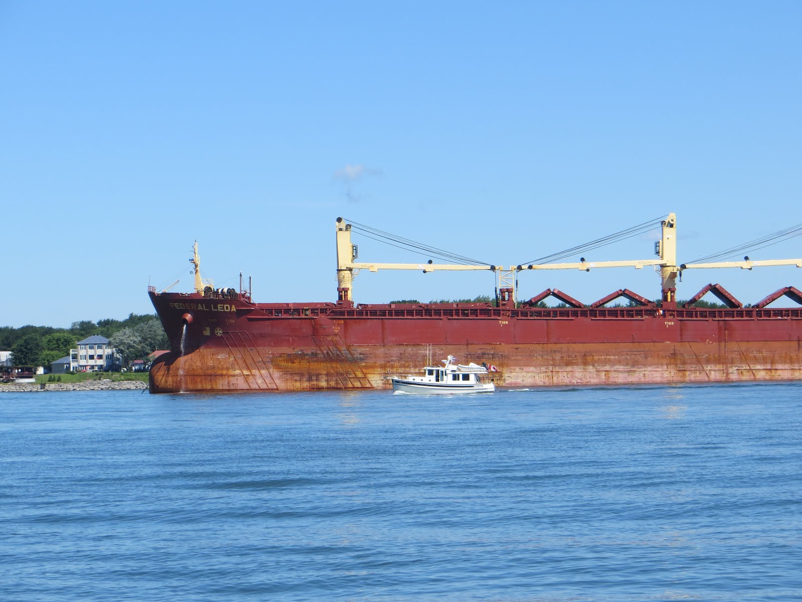
We assumed (incorrectly) that we had to follow written procedures and dock at the entrance to the lock, use the phone to announce our presence and buy a ticket from a machine for transiting the lock. We found out later we could have just pulled straight into the lock and paid by cash. The decision cost us a 2 1/2 hour wait due to another down bound freighter and an extremely long freight train passing, both having priority over pleasure craft. 
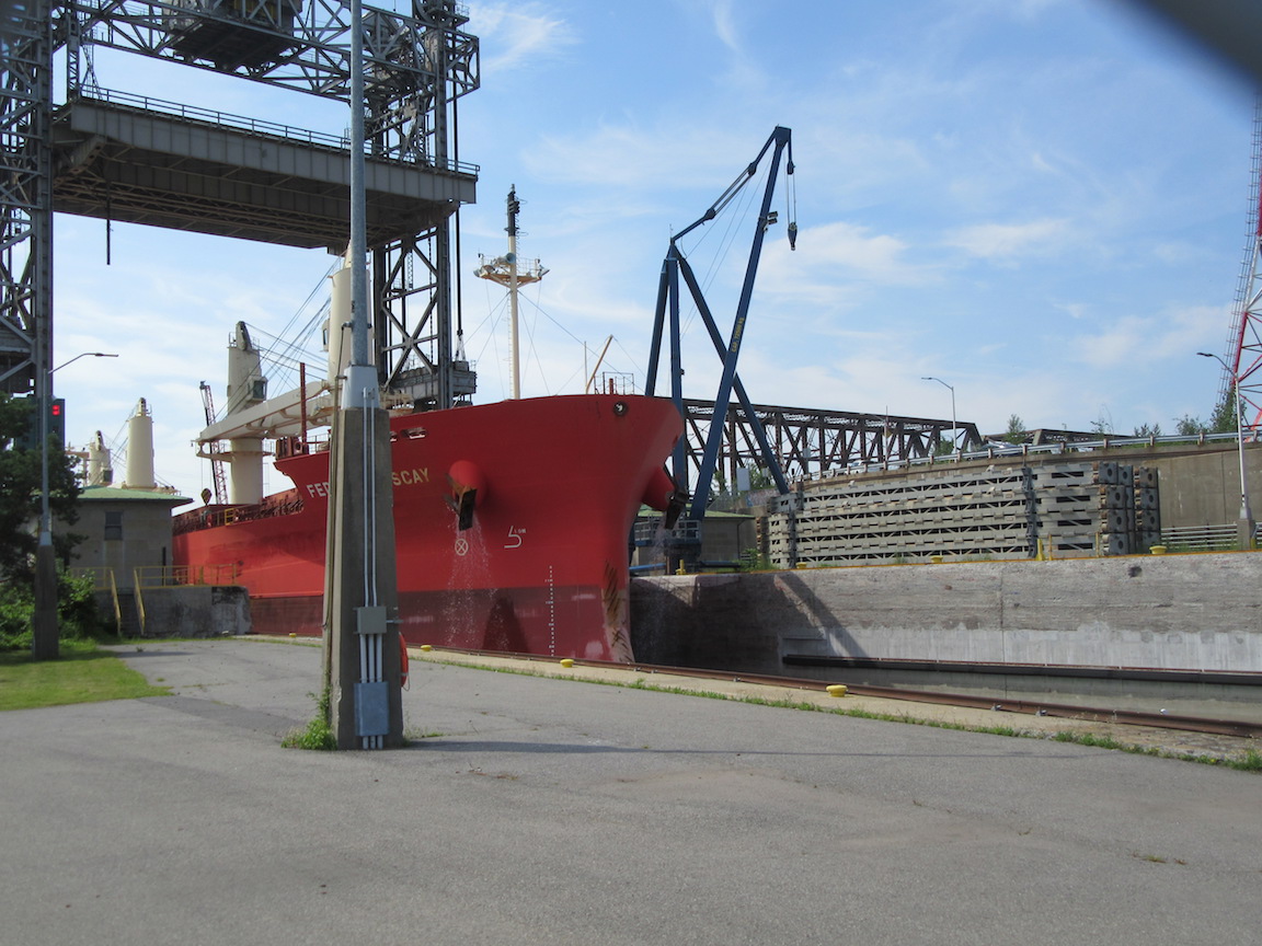
Long wait for this freighter to get through the lock

Our turn in the Seaway Lock

In close quarters with another ship

As a result of the delay, we didn’t arrive at Ste Anne de Bellevue until about 1715 hours and by then, all lock tie up spaces were taken. We later learned that due to high water, the lock tie up space all along one side of the entrance channel was still underwater and not useable. In fact, in late April/early May, the water level was so high, the lock was completely submerged and the main street of the town was also flooded (that would amount to water level about 8 feet higher than what we saw).

We made a quick decision to head through the lock and continue out onto Lac des Deux Montagnes to an anchorage the lock master recommended in Baie De Ille Cadieux. This lock is a very busy one and on our lock through, it was absolutely packed with boats rafted three deep. Heading out to anchor turned out to be a good decision where we were able to enjoy a swim to cool down after a rather long, hot day. Later that evening, the sky darkened and once again we were treated to thunderstorms on three sides of us (none directly overhead). We were treated to a great light show, with no wind or rain.

Large number of boats in Ste Anne Lock

Thursday August 2, 2017: We decided we didn’t want to arrive in Ottawa until Monday August 7th as it was going to be a long weekend and it would be difficult to get a tie up in the canal in downtown Ottawa. So, we chose to backtrack to Ste Anne de Bellevue mid morning in the hopes of getting a spot to tie up there for the day. We locked back through the Ste Anne lock and successfully got a space for both boats on the canal wall. Ste Anne is a suburb of Montreal, located at the western tip of the Island of Montreal. It is the second oldest community on the island, established in 1703 due to its strategic location at the junction of the St. Lawrence River and the Ottawa River. 

The name Bellevue came from a fiefdom granted to Louis de Berthe and his brother Gabriel in 1672 by King Louis XIV of France. Later, in 1712, Rene-Charles de Breslay, a local parish priest, got caught in a fierce snowstorm and fell from his horse breaking his leg on the ice. He was allegedly saved through intervention by Saint Anne, after which he built a chapel dedicated to her at the westernmost point of Montreal Island. Two years later, the parish was established and took the name Saint Anne du Bout de Ille. 

From the early 1800’s, the town became a place of literary pilgrimage after Thomas Moore, the famous Irish composer, who wrote one of his most celebrated works here, "The Canadian Boat Song". The Sainte-Anne Canal was completed in 1843 increasing the number of travellers and merchants passing through the town. In 1854, the Grand Trunk Railroad was built through the town, followed by the CP Rail in 1887. Ultimately, in 1878, the town was renamed Ste Anne de Bellevue and in 2002, Ste Anne was merged into the City of Montreal. Today its population is just over 5,000.

Tug'n tied up in canal at Ste Anne

During the day, the town and its main street seem very relaxed and quiet. The many restaurants seemed rather quiet. But it is at night when this town comes alive. People arrive by boat and car and fill the restaurants and clubs. They walk the canals to look at the boats. They sing and dance at nearby clubs. We really enjoyed the town, shopping at several boutiques, dining out for lunch, walking the waterfront and main street and chatting with other boaters. The noise level really picked up in the evening with music from a local jazz club and restaurants and voices and laughter filled the air. But it was all quiet again by 2230 hours, so we got to enjoy a quiet evening. 

Lunch at Resto Bar

Friday August 3, 2017: We awoke to more sunny summer weather and enjoyed some more of Ste Anne de Bellevue through the morning and early afternoon. We were all ready to depart at 1330 hours when a thunderstorm blew through with heavy rain and lots of lightening, shutting down the lock. Regulations require the lock be closed during a thunder storm and it must remain closed for a further 15 minutes after the storm is finished, for safety reasons. So, about 1500 hours, the lock reopened and by then, there was a backlog of boats resulting in a very full lock. Later we would discover that while in the lock, the freight train that passed overhead left an enormous amount of dirty splatters all over our boats from the bridge and train. When we got to our anchorage, back at Baie De Ille Cadieux (where we’d anchored on Wednesday night), we had a major clean up job to complete. This was followed by a swim, dinner and another significant thunderstorm, including winds of 30 knots with gusts to 36 and an enormous amount of rain in the evening and off and on throughout the night.

Saturday August 4, 2017: Today we headed a further 20 nautical miles up the Ottawa River. We wanted to anchor close by the famous Chateau Montebello as we’d made a reservation for Sunday to stay at the Yacht Club on the site of the resort. Being close by would ensure we got there in good time to enjoy a full day at the resort.. 

We had a very windy day on the water with steady 20 knot winds and gusts to 30, but as we were on the winding Ottawa River, the water was relatively calm. Today we went through the second of only two locks on the Ottawa River, at Carillon. This is no ordinary lock site. Carillon, together with the Grenville Canal and the Chute a Blondeau Canal were built to navigate the Long Sault Rapids on the Ottawa River that stretched for 21 kilometres. The impetus for these canals was the War of 1812, during which attacks along the St Lawrence River jeopardized the communication lines between Kingston and Montreal, the two main military positions of Upper and Lower Canada. The Ottawa River Canals and the Rideau Canal were designed as an alternate military supply route in the event of war with the Americans. 

Captain Henry Vernet of the Royal Corps of Engineering from England arrived to head construction of the project.  Hundreds of Irish immigrants and French Canadians were used to excavate the canals under direction of a hundred British soldiers. In 1833, the Grenville Canal was completed, a length of 5.9 miles and the entire network on the Ottawa River, including all 11 locks was not fully completed until 1843. All specs were designed for military needs: 134’ long, 33 feet wide and 5 feet deep. They were perfect for the military but too small for any commercial use.  Logging became a big economic driver in the region and local business people demanded the government carry out improvements as the canal had quickly become outdated. Between 1873 and 1882 improvements were made in the dams, water levels and locks such that the Chute a Blondeau Canal section was no longer needed. Further changes were made in 1963 with the construction of the Carillon hydroelectric dam and now a single lock of 66 feet in height replaced 7 locks. This new waterway flooded the rapids of Long Sault transforming them into calm water.

Approaching Carillon Lock with guillotine door

Guillotine door closing behind us

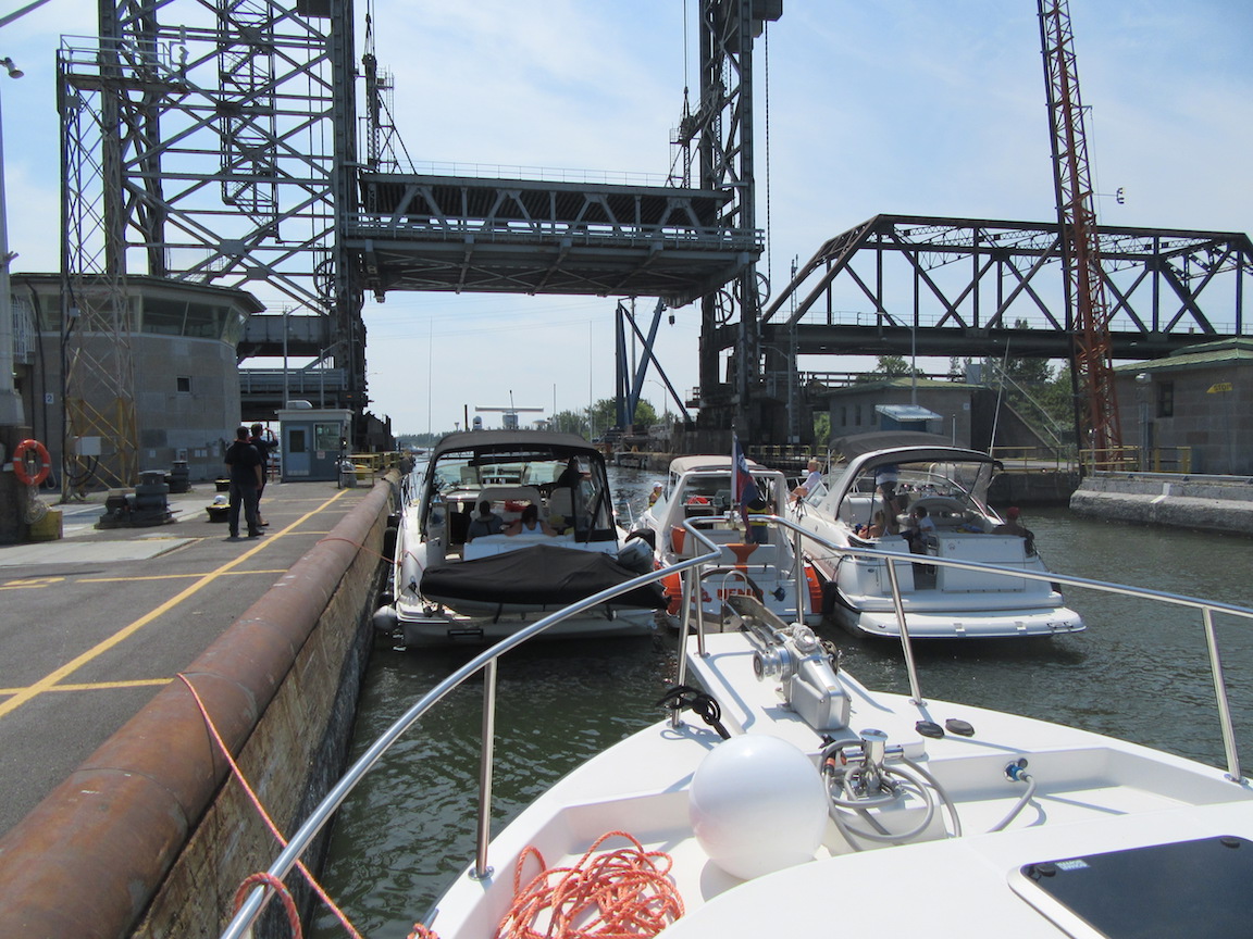
This new lock is quite an engineering marvel. Normally locks have a pair of upper doors and a pair of lower doors. In the new Carillon lock, while the upper doors are traditional, the lower doors are instead a single 200 ton guillotine style steel door, partially offset by a 150 ton counterweight. Inside the lock is a dock along one side where the lock staff greet boaters, taking their lines and tying up the boats. Often boats are rafted two and three deep to fit them all in. It takes 45 minutes for the lock to fill its 66 feet rise.  This lock is truly a marvellous sight to see.

Tug'n inside the Carillon Lock

Several times through the afternoon we had horizontal rain rinsing off the boats and we were delighted with the relative calm of the anchorage at Baie des Autocas that had been recommended by a fellow boater we spoke with in Ste Anne. 

Manicured property along Ottawa River

This afternoon was another boat maintenance time. Earlier, we’d discovered that one of our three bilge pumps near the drive shaft through hull fitting, would automatically come on to get rid of the small accumulation of water, but would not shut off. Its float switch was no longer working properly. I’d found an exact replacement while on the Chambly Canal and today was the day to replace it. While it wasn't a difficult job, the wiring was the time consuming part. Once done, happy hour was the reward, followed by dinner and a Netflix movie.

Maintenance job in bilge under salon floor

Sunday August 5, 2017: It was less than a 7 nautical mile run from Baie des Autocas to the Yacht Club at Chateau Montebello but it took us almost 2 hours as we had a brief fuel fill and holding tank pump out en route. As you approach the Chateau Montebello site, this immense, impressive log structure on a well treed property comes into view, captivating one to just stare and try to take it all in. The Yacht Club is in a relatively small basin cut out of the shoreline and it was packed with boats. Clearly our reservation was required. 

Our first view of Chateau Montabello 

The Chateau has an interesting history. The resort is located on a property originally know as the Seigneurie de la Petite Nation which belonged to Bishop Montmorency de Laval, a founder of Quebec. In the 19th century the property was passed into the hands of Joseph Papineau, a member of the legislative assembly and then to his son, Louis-Joseph Papineau, who played an important role in the Rebellion of 1837. Louis-Joseph Papineau constructed the Manior Papineau in the mid 1800’s. His home, a highly treasured heritage location on the grounds of the resort, is now a National Historic Site, run by Parks Canada. 

The remarkable log chateau was built in 1930 at the onset of the Great Depression. The first log was laid on April 7th and the massive structure was completed in only three months. The chateau is shaped as a six point star and it was built out of 10,000 hand cut and set red cedar logs transported by Canadian Pacific Rail from the forests of British Columbia. The project was the dream of Swiss-American H. M. Saddiemire who was inspired by the chateaux of the Swiss alps. A Finnish master builder named Victor Nymark oversaw the work of as many as 3.500 craftsmen. To complete the construction so quickly, work was done around the clock with overlapping shifts, seven days a week, using electric lights at night. The church did no approve of working on the sabbath, but by coincidence, the local head of the church was dispatched on an all expenses paid trip to Rome for two months while the work was completed. 

For 40 years, the chateau was a private retreat “The Seignory Club” whose membership included prim ministers, royalty and Canada’s business elite. In 1970 the resort was ought by Canadian Pacific Hotels and opened to the public. It quickly became one of the premier resorts in Eastern Canada. In 1981, the Fairmont Chateau Montebello played host to the leaders attending from the G7 Economic Summit. And in 1983 a NATO conference was held here. 

G7 Summit at Chateau Montabello 

I clearly remember my father and step mother boated the Rideau, Ottawa River, St. Lawrence, Lake Champlain, Eric Canal back to Lake Ontario and they talked fondly of their experience at the Chateau Montebello, so we were naturally very excited at the prospect of a stay at the resort. We were not disappointed. The building itself is a marvel with its enormous 66 foot high rotunda containing a six sided fireplace and soaring rafters made of logs 60 feet long. It contains 211 guest rooms including 14 suites, all organized in four wings fanning out from the rotunda. The two additional wings contain the dining room and ballroom. 

The 65,000 acre site is a retreat and forested wildlife sanctuary with 70 lakes. Its amenities included indoor and outdoor swimming 
pools, an 18 hole golf course, 26 kilometres of cross-country and/or hiking trails and much more. 

Fran exploring gardens

Magnificent rotunda in Chateau

On a trail walk

BBQ dinner in front of Chateau

We wandered the grounds and marvelled at its magnificent gardens and flowers. The two pools were being well used and the hiking trails through the forests were a delight. While there, we decided to attend their daily evening BBQ dinner on the terrace in front of the Chateau. It was a somewhat overwhelming eating extravaganza that our bodies are thankfully not well equipped for, but we did our best, sampling the extraordinary number of the salads, grilled meats sea foods & vegetables and of course the desserts. We had some limited success in trying to pace ourselves and the dinner stretched out to two hours, followed by a desperately needed walk on the grounds as the sun set over a cloudless night. Needing more time to digest our meal, we sat up and watched a Netflix movie. 

Monday August 7, 2017: Mid morning, we bid au revoir  to Chateau Montebello and to Quebec as we headed a further 36 nautical miles up the Ottawa River. It was a very pleasant cruise on this winding river passing rural areas and smaller communities before the more populated Gatineau on the Quebec side and then Ottawa on the Ontario side of the river. 

It is fair to say arriving at Ottawa by boat is very impressive indeed. You are greeted by many fine homes in the Rockcliffe Park area, followed by the magnificent Rideau Falls and finally, as you pass under the Alexandra Bridge you are greeted by the panoramic sight of Canada’s Parliament Buildings, the flight of Rideau Canal locks 1 through 8 and the magnificent architecture of the Chateau Laurier Hotel. It really is a sight that makes one pause and think how special this city of Ottawa really is. 

Parliament Buildings in Ottawa

Fight of 8 locks and Chateau Laurier Hotel

Excess water flowing over lock doors

We tied up at the “blue line” where one waits for their turn to get through the locks. We could see there was a small group of three boats part way up the eight locks. There were crowds of tourists everywhere, watching and picture taking the operations of these magnificent locks. I wandered up to lock number six to speak with the lock master and learned they would manage to fit us in at about 1630 hours for the 90 minute procedure. They had two more boats to “bring down” the locks before it was our turn. Excess water in the system was readily evident as an enormous amount of water was pouring over most of the lock doors all the way down the 8 locks. 

We prepared our boats with lines and fenders for the procedure. The lock master warned us that they’d be putting us through quickly and to expect some turbulence in the locks but “your boats are big so you should be able to handle it ok”. Thankful that we were going to get through today and not have to wait for Tuesday, I replied “we will do our best”. We and Bob and Jan on Wings were well prepared, but there was a lot of turbulence and after 90 minutes of holding lines and fending off our boat from the lock walls, we were happy to get docked on the canal wall in downtown Ottawa by 1830 hours. The lock staff did a great job for us. I have no idea how many photos were taken of us, but the sides of the 8 locks were packed with spectators as was the road bridge at the top. While this is the third time for Fran and I to be on the Rideau together and my forth time (once as a child), we’d never transited these 8 iconic locks at Ottawa. It is great to do it, but I don’t think we need a repeat.

After a well earned happy hour in our cockpit, relaxing with Bob and Jan, it was a quiet dinner and evening as we anticipate what we’ll be doing over the next few days in our Nation’s Capital

Sunset - Rideau Canal in Ottawa

Monday, July 31, 2017

THE RICHELIEU RIVER & CHAMBLY CANAL

Map of our route for this blog post


Tuesday July 25, 2017: We awoke to a very chilly 15 degrees and overcast morning, shortly after the overnight rain finally stopped. We had a slow morning, having decided we were only going a short distance for one more anchorage on Lake Champlain - Pelots Bay (pronounced pee lots) only 7 miles away at the north end of North Hero Island. We left mid morning and gradually the sun came out while we were underway. The anchorage had been rated high for good weather protection but low for scenery, so we were pleasantly surprised, finding it quite appealing. We arrived at noon and found only one other boat anchored there, but by end of day we had a half dozen more boats to share the anchorage with. 

The rest of the day was spent doing a few minor boat chores, primarily doing engine room checks, including seeing if the generator anode needed replacing (it didn’t - light usage meant minimal wear). We also got organized to re-enter Canada tomorrow morning:
  • Pull out passports and Nexus Cards
  • Obtain phone number for call in to Canada Customs & Immigration
  • Do inventory of liquor, wine and beer (I got scolded one other time on a call in when I did not have this info handy)
The rest of our day was spent reading in the cockpit and relaxing. Fran put on a marvellous dinner of shrimp scampi on pasta.

Wednesday July 26, 2017: Our plan today was to rise and depart early for Rouses Point, NY (15 nautical miles away) to get a holding tank pump out and a water tank fill, then stop at the Canada Customs & Immigration Pier (< 2 miles further north) then start down the Richelieu River for St-Jean-sur-Richelieu, which is the start of the Chambly Canal. 

Wings passing under first bridge on Richelieu River

Children from summer camp on Richelieu

The Richelieu River flows north from Lake Champlain to the St. Lawrence River in the Province of Quebec. It was formerly known as the Iroquois River and the Chambly River and it was a key route of water transportation (for First Nations tribes for thousands of years) and subsequently for cross-boarder trade between Canada and the United States until the arrival of the railroad in the mid 19th century. The area was coveted by both French & British colonial powers in the 17th & 18th centuries and because of the Richelieu River’s strategic position numerous military fortifications were erected on the shores of the river. The river was also a key pathway for several military tours and the scene of several battles between the end of the 17th century and the early 19th century, including:
  • between the French & the Iroquois, then
  • between the French & the English and then
  • between the English and the Americans

In the 19th century, the Richelieu River became an important economic pathway instead of a war path. The 1843 construction of the Chambly Canal was completed, bypassing the rapids, allowing easier transportation of export products such as sawlogs, pulp, hay and coal from Canada to the US. Eventually a network of channels was built which connected Lake Champlain to the Hudson River and the Erie Canal connection to Lake Ontario and Lake Erie. This dramatically increased traffic through the Richelieu River. 

By the end of the 19th century, railroads largely replaced the river as a commercial artery. Today, pleasure craft and tourism have contributed to the regional prosperity of this “heritage corridor”. 

So, en route to Rouses Point, we had our call in with Canada Customs and Immigration. Upon arrival at their pier, all they wanted was the reporting number we’d been given over the phone and we were on our way. Heading downstream was quite lovely as we got to enjoy a 1.5 to 2.0 knot current in our favour. The river is lined with trees and homes and it was a delightful cruise to the town of St-Jean-sur-Richelieu. The lock master advised the best overnight spot was on the lower side of lock 9 (the first lock), so we passed under the swing bridge and tied up about 1330 hours. Bob and Jan on Wings had already scouted out a highly rated restaurant (Pizza Richelieu) for a late lunch where we thoroughly enjoyed their signature pizza. Later, Fran and I walked to a first class Metro grocery store and bought way more supplies than our arms would ever want to carry. 

We enjoyed a lovely happy hour with Bob and Jan in the cockpit of Wings before retiring for a quiet evening.

Colourful street in St Jean sur Richelieu

Thursday July 27 & Friday July 28, 2017: St-Jean-sur-Richelieu, the start of the 9 mile Chambly Canal which bypasses the rapids, was built between 1831 and 1843. It has 9 locks, and while there has been some automation applied, the locks look pretty much the same way today as they did when first built. The lock dimensions (110 feet X 21 feet) are quite a bit smaller than most of the locks on the Trent-Severn and Rideau Canals and sections of the canal are so narrow, only one way traffic is allowed. Boat movement through the canals is all controlled by communications between the various lock masters. 

Homes along the Richelieu River


Today, our plan was to go from Lock 9 at St-Jean-sur-Richelieu to the top of lock 3 at Chambly.  The lock master had us wait until she had four boats coming down her lock. She radioed us to start through the first section of the canal, just as the four boats exited the lock, so now there were six of us together heading through the narrow canal. Their strategy works well as there certainly wasn't room for boats to pass one another in lengthy sections of the canal. The staff at all the locks were wonderfully friendly, helpful and attentive, always checking to be sure we were ready for the lock to start going down. While six boats started out together, they locked just Tug’n and Wings together as the lock did not have room for more boats. 

Tug'n on Chambly Canal, Richelieu Rapids to the right

Wings passes under bridge

An interesting design feature of the locks was the use of timbers in the lower part of the lock walls with stone blocks on top. I assumed this was to protect the lock walls during the winter freeze, but the lock master told me it was a cost saving measure. None of the Trent-Severn or Rideau Locks use this method and I'm not entirely sure I got the correct information.

Timbers used in lower part of lock walls

Chambly turned out to be a delightful town. It is home to French fortification, Fort Chambly, a national historic site. It also has many fine restaurants, overnight docking for boaters and the final three “flight locks” (three locks all together) in the Chambly Canal. We ended up staying two nights in Chambly where we toured the fort, did lengthy walks about the town and its parks, enjoyed a wonderful lunch at La Cochonne Rit (The Happy Pig), had Happy Hours under the shade of the trees at the lock and dinners in our cockpit. One evening we enjoyed the company of Michel and Diane and their son, daughter-in-law and grand children who were travelling aboard a Monk 36 trawler named Tremolo II. Michel had some recommended stops for us on the remainder or our run down to the St. Lawrence as well as a small craft channel to take for the bulk of the run up to Montreal.

Happy Hour by the Chambly Canal

Cockpit dinner for two

Fort Chambly


Saturday July 29, 2017: Another beautiful, sunny day greeted us for our run from Chambly to St. Ours on the Richelieu. Passing through the three flight locks at Chambly is a slow process. The lock master first took a load of five boats from the lower side, up bound first. It took about one hour to finish bringing them through the locks before it was our turn to head down bound. First, the lock master swung the bridge and then opened the gates to lock #3 for us, Wings and two smaller boats. Then the lock gates were closed, the bridge closed and down we went one level. The lower doors opened and one by one, we entered lock #2 and followed the same process for lock #1. After an hour, we were on our way further down the Richelieu River. 

Locks 3, 2 & 1

One of many churches along the Richelieu

Once again, this section of the river is just lovely with tree lined shores, lovely homes, occasional marinas and more & more boat traffic. We cruised about four hours to cover just over 27 nautical miles of the Richelieu River to a final lock near the village of St. Ours, Quebec. This lock is much large and different than the earlier locks on the Chambly Canal. The original lock at St. Ours was replaced by a larger one (300’ long) to handle demands of the commercial trade later in the 19th century. Today the lock is only used for pleasure craft, so the lock has been adapted to maximize its functionality with the addition of a floating dock along one side of the lock. Boats entering the lock tie up to the dock and if the volume demands, boats will be rafted three deep. While unusual, it actually works extremely well. When we passed through, we had sixteen boats in the lock at once with boats rafted two and three deep. 

St Ours Lock with dock inside


We tied up on the floating docks at the lower side of the lock for the night in a perfectly lovely, park like setting with lots of trees, shade and picnic tables. Parks Canada, who run the lock systems, offer a unique camping experience - a cross between a tend and a rustic cabin, called “oTENTik”. Each unit comes with three beds set up to accommodate up to six people. They have fire pits for each tent and a sheltered set of counters and sinks in a shelter for the renters to use. Its a great way for families or friends to enjoy a camping experience without all the muss and fuss. The St. Ours lock had five oTENTik units on site and all were in use. They looked really great and a superb use of Parks Canada properties. They are also located at selected lock sites on the Trent-Severn Waterway and the Rideau Canal.

oTENTik

Before dinner, we took a walk around the property including a walk across the St. Ours dam to look at the fish latter that has been built to facilitate fish migration up stream. We enjoyed a lovely evening at St. Ours Lock, a highly recommended stop.

Wings & Tug'n at St Ours Lock

Fish Ladder

Sunday July 30, 2017: Our streak of lovely summer weather continues another day. Today we will complete the last section of the Richelieu River and enter the St. Lawrence River at Sorel. While it was much the same as earlier sections, we can’t state often enough how pleasant an experience it is cruising down the Richelieu River. It is so very scenic and relaxing. Today is a Sunday, so boat traffic was plentiful, including some wake boarders and water skiers, but navigation was dead simple. It was less than a two hour run to reach Sorel, where the Richelieu River spills out into the St. Lawrence River. That was the end of the favourable current pushing us along and giving us great mileage on Tug’n. On the St Lawrence we were now heading upstream facing a current of 1 1/2 to 2 nautical miles per hour against us. 

Tug'n & a big ship

Today we went only a short distance up the St. Lawrence to an anchorage recommended by Michel off of Tremolo II which was through a narrow channel to anchor beside Ile au Cochons. It is a rather unique anchorage on the north side of the St. Lawrence, with what looked like a steel plant on the south side of the river. In between us and the river is a low lying grasslands so we had a great view of the ships and other boat traffic going up and down the St. Lawrence, with no waves to disturb us. On our other side, we had the tree lined shore of Ile au Cochons. A one knot current kept all the anchored boats neatly lined up. 


Later, we launched our dinghy and took a tour through part of the local channels around islands in the area, enjoying a very pleasant cruise past homes, small marinas, unoccupied islands, fishermen and lots of bird life, all in protected waters, but with current of the St. Lawrence river. Afterwards, we had a game of Sequence over Happy Hour with Bob and Jan on Wings. That night, we re-watched the movie Lion (Netflix), a wonderfully filmed true story, well worth watching if you’ve not seen it. A great end to a fun and rather exciting day, getting back on the mighty St. Lawrence River.

Ile au Concons anchorage

Tuesday, July 25, 2017

LAKE CHAMPLAIN - BOB & the SHERIFF'S MEN

Our route for this blog post


Friday July 21, 2017: We are starting to feel a tad bit guilty about the wonderful summer weather we’ve been having for the past five weeks when we hear from family and friends how damp and chilly it has been back home in Ontario. But five minutes later the feeling passes and we are ok again.

Beautiful shoreline on Willsboro Bay


We had a wonderfully quiet night at Willsboro Bay last night on the west side (New York) of Lake Champlain. This morning, we are up and underway by 0900 hours to a very popular anchorage at Malletts Bay on the east side (Vermont) of Lake Champlain. It does seem odd to be moving back and forth between two States on your boat, day by day. Once we got out in open water, we were surprised to fine waves for the first time on Lake Champlain. It’s mostly been dead calm ever since we got on the Lake, but we’d heard it can get quite rough with little notice. Anyway, the waves were not too uncomfortable, hitting our stern at an angle and causing the boat to swirl back and forth from time to time. 

Malletts Bay is reportedly one of the most popular boating areas on Lake Champlain. It is actually two bays - a larger outer bay and a much smaller and more protected inner bay. Mallets Bay is separated from Lake Champlain by a long railroad causeway that is no longer used and the narrow entrance is at the location of an old swing bridge. The inner bay was our objective today and it offers numerous anchorages, depending on the wind direction. Here, the wind mostly blows either north or south, due to the mountain ranges on both sides of Lake Champlain. Today it was a strong south wind, so the protected anchorages were all on the south side of the inner bay. As we soon discovered, the south shore is also where all the marinas, cottages and mooring fields are located. So while it wasn’t hard to find a place to anchor, the scenery was not very appealing as you were virtually surrounded by marinas and boats on mooring balls. The more secluded and visually appealing anchorages were on the north shore with a strong south wind blowing into them. A short conference call with Bob and Jan (who were just leaving a marina in Burlington, Vermont) and we were off to our next choice of anchorage, Valcour Island, back on the New York side of Lake Champlain. 

With each passing day, we are seeing more and more Canadian boats and Quebec boats are dominating the scene. They outnumber New York and Vermont boats by a wide margin. Valcour Island has 1,000 acres of publicly owned forest, camping sites, 7 miles of hiking trails and five anchorages with good holding for anchoring and some even with beaches. 

During the Revolutionary War in the fall of 1776. Benedict Arnold took his fleet north on Lake Champlain to intercept the British Fleet under Guy Carleton, who was intending to attack the Americans at Ticonderoga. Benedict Arnold realized his fleet of 15 vessels faced a far superior British fleet, so Arnold positioned his fleet out of sight, along Valcour Island’s west shore, knowing the British would take the wider channel on the east side of the island. The British passed Valcour Island on September 23, 1776 with a north wind and after they passed, several American vessels left the anchorage to attack. The British fleet struggled to tack back into the north wind to engage the American fleet. A gun battle lasted late into the day, until the British fleet formed a blockade across the south end of the channel. Overnight, helped by darkness and fog, the American fleet slipped away and headed south for protection by Crown Point. The British pursued and a moving battle ensued until Benedict Arnold was forced to run most of his fleet ashore in Arnold Bay. The British finally reached Ticonderoga and were surprised to find the fort well protected with cannons and troops, so the British retreated to Quebec for the winter, setting the stage for a British defeat at Saratoga in 1777.

We chose an anchorage on the north side of Valcour Island offering protection from the strong south wind. As then day went on, more and more boats arrived and the count was finally about 50 at dusk, with the bulk carrying either a Fleury-De-Lis, a Canadian Flag or both. Unfortunately, flag etiquette is not highly regarded by many of the boaters on Lake Champlain, with many flags being an inappropriate size and location on the boats. The water was pristine for swimming and certainly very refreshing to cool one down on this hot summer day. Despite the large number of boats in the anchorage, all were well behaved and a quiet night was enjoyed by everyone.

Saturday & Sunday July 22/23, 2017: A gusty north wind greeted us early this morning, prompting us to move to another of Valcour Island’s anchorages for more protection from the wind and waves. This time, we moved to the west side of the island, just south of Bluff Point. This was a much larger anchorage and we were pleased to find another 37’ Nordic Tug named Calypso. Mid morning we lowered our dinghy and went over to introduce ourselves to owners Jeff and Linda from Plattsburgh, New York. They are new owners and had lots of questions about what changes and upgrades we’d done, so we had them over to see Tug’n later in the day.

Busy, entertaining anchorage at Valcour Island


Afterwards, we went to visit with Bob and Jan. Bob had just lowered his dinghy and was planning to take it for a run, as he'd had it in the lake since we’d left the salt water. Also, he’d not had a chance to give his brand new dinghy a fast run, up on a plane, so we volunteered to take some photos of him. After a short run, Bob stopped to adjust the trim of the motor. Moment’s later, we were surrounded by five local Sheriff’s deputies on two Sea Doos and one Boston Whaler with their blue and red lights flashing. One officer pointed to our dinghy noting “yours appears registered ok”. Then he looked at Bob’s dinghy and asked for registration papers. Bob carefully explained it was a new dinghy and despite his best efforts and those of the Zodiac dealer he bought it from, they were unable to register the dinghy in the State of Michigan until Bob and Jan got home. Well, that wasn’t good enough for the Sheriff’s men from the good State of New York. They wanted to see Bob’s identification and escorted him back to Wings. As Bob climbed aboard Wings, he said to Jan under his breath, “I’m in trouble”. Half an hour later, five officers of the law said their good bye’s leaving Bob with a ticket for $250, explaining that this was a serious matter of safety and they gave him strict instructions not to use the dinghy until it had been properly registered. 

Bob, just before the Sheriff's men caught him


While clearly a warning would have done the job, at dusk, the real safety issues occurred with several boaters on Sea Doos (no doubt the riders were fuelled by alcohol), tore in and out of the anchorage at speeds exceeding 50 miles per hour. By this time, there were over 100 boats in the anchorage, but unfortunately, there were no Sheriffs men in sight. 

We dutifully emailed Bob and Jan copies of the three photos we managed to take of Bob on a plane in his new dinghy. Those were very expensive photos!


In the afternoon, we went ashore to hike one of the trails to visit Bluff Point Lighthouse. It was clear we took a wrong turn heading to the lighthouse as our route had some very rugged ups and downs. A young family at the lighthouse pointed us in the right direction to take the shorter and more leisurely route back to our bay. 

Bluff Point Lighthouse

The Bluff Point Lighthouse was built in 1874 and was in service until 1930. From 1876 to 1881 it was manned by Civil War Veteran Major William Herwerth, who died on the job. His wife Mary was given command of the lighthouse which she maintained until 1902. When the lighthouse went out of service in 1930, it was bought by a dentist who used it as a summer residence. Later, it became part of the Adirondack State Park. The Clinton County Historical Association restored the lighthouse and it is now open on Sundays in the summer for tours. 

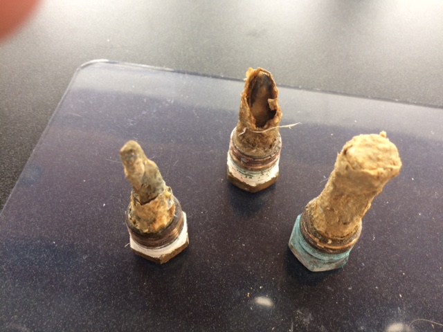
We stayed another full day at the anchorage and completed a few more chores including some more stainless steel work as well as changing the main engine sacrificial anodes from zinc (used in salt water) to magnesium (for use in fresh water). Your engine, shaft, propellor, rudder etc are vulnerable to galvanic corrosion from contact with the water. Sacrificial anodes are designed to corrode first, before the more noble metals on your boat. Different anodes are required for salt water, vs brackish and fresh water. As you can see from the photo, our zinc anodes did their job well and were just about past their “best before date”. 

Our old zinc anodes have done their job

It was another lovely day on Lake Champlain with a mostly sunny day. Activities included another swim, a visit to a nearby marina to buy a bag of ice, another game of Cross-Crib where Bob and I lost to Jan and Fran for the third straight time and much entertainment watching boats come and go in this busy, beautiful anchorage.

Monday July 24, 2017: It is a cloudy day with all day rain forecast. We are nearing the end of our stay on Lake Champlain as we gradually move further north towards the Quebec boarder. The wind swung around to the south early this morning and is forecast to pick up to 20 knots so a move was imperative. We chose Nichols Point at South Hero Island, a distance of just under 10 nautical miles. 

While underway, the rain got heavier, the wind got stronger, the waves got bigger and the temperature dropped. It’s been more than a month of hot summer weather and today we are now back in long pants, having hot tea instead of iced tea. We quickly got the anchor down and then hibernated in the cabin, reading, cooking, writing and planning the next stage of our trip with the upcoming boarder crossing, the Richelieu River and Chambly Canal. Each boat does their homework and then we confer with Wings and make our cruising decisions. Both boat crews are very agreeable and these decisions usually take only a short while.

It continued to rain off and on all night and the temperature got down to 14 degrees C (a duvet night).

Our rain day at Nichols Point


Tuesday July 25, 2017: We woke up to a cool morning, but the rain seems to have stopped. We decided to try one more anchorage on Lake Champlain before heading into the Richelieu River tomorrow. Pelots Bay was just under 7 miles away. While fairly non-descript, it is well protected. Interestingly, the trees on one side of the bay appear to be turning colour already - this is way, way too soon.

No plans. Nowhere to be. Just a relaxing day.

Weed harvester at work in Pelots Bay