British Columbia – Fernie to Hope: A Bunch of Firsts
As we continue westward along Highway 3 (Crowsnest Highway), the winding roads, dramatic mountain passes, and breathtaking scenery never cease to amaze us. After Fernie, our next stop was Creston, BC—a charming town of about 5,300 people nestled in the fertile Creston Valley between the Selkirk and Purcell Mountains. Thanks to its mild climate and rich soil, Creston is one of BC’s premier agricultural hubs, second only to the Okanagan in fruit production. The town’s economy is driven by agriculture, forestry, tourism, local wineries, and the Kootenay Brewery.

Lunch at our campsite in Creston BC
Creston – Wine, Locals, and Lakeside Advice
In Creston, we visited Skimmerhorn Winery and enjoyed a delightful wine tasting accompanied by a delicious charcuterie board. We sat on a deck overlooking the vineyards, surrounded by majestic mountains—it was absolutely perfect.

Wine tasting at Skimmerhorn Winery in Creston BC

A delicious charcuterie board

Great view of their vineyard and mountains
The next morning, we joined a pancake breakfast fundraiser at a local seniors’ home. We had a great time chatting with residents who were curious about our trip. One couple in particular recommended a more scenic route for our next leg—Highway 3A instead of 3—which hugs the shoreline of Kootenay Lake and includes a free ferry crossing. We mapped out our travel and charging plan and hit the road.

With locals in Creston for a pancake breakfast
Kootenay Lake and Our First Ferry Ride
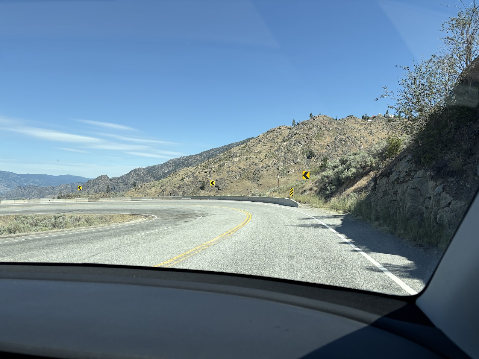
The drive along Kootenay Lake was stunning, with regular views of the lake framed by surrounding mountains. Fran enjoyed most of the scenery while I kept focused on the road—non-stop curves, climbs, descents, and frequent speed changes made it one of the most challenging drives yet (second only to navigating Winnipeg’s narrow streets while towing our 28’ trailer).

Very windy road along Kootenay Lake

We also experienced our first-ever ferry ride with the trailer. Though we arrived an hour early, five long lines of vehicles were already waiting. We didn’t expect to make the earlier ferry, but somehow we did—alongside a logging truck, about 30 motorcycles, RVs, motorhomes cars and loads of trucks. It was a perfect day to ride on the upper deck and soak in the panoramic views.
The winding roads and scenic beauty along this route are clearly a magnet for motorcyclists, many travelling in groups—some packed for camping, others geared up for off-road adventures.

Lined up for the Kootenay Ferry

A full load

A view from the water
Charging Challenges in Nelson and a Close Call
Our next stop was Nelson, where we aimed to charge the car at a Flo charger. The parking lot was tight and busy and very challenging to find a place to unhitch. One of the two chargers was in use. I struggled with the charger for five minutes before realizing it was out of service. With no sign of the other vehicle’s owners, we re-hitched and drove on, planning to go as far as we could before unhitching again to drive ahead and charge the car.
Another first: I arrived at the next charger with just 1% remaining—a little too close for comfort. After charging to 100%, I drove back to pick up Fran and the trailer, which we’d left at a closed restaurant. Onward we went.
Lavender Fields Forever in Grand Forks
In Grand Forks, we camped at Love n’ Der Farms, a beautiful lavender farm owned by Steve, a retired Ontario Hydro worker. We were one of four RVs camped out with a field of lavender in front of us and mountains all around. Fran loved browsing the array of lavender products—everything from essential oils and creams to teas, seasonings, shampoo, and perfume.
As with most Harvest Hosts sites, there were no hookups, and it was a scorching 34°C day. Knowing it would cool down overnight, we opted to have dinner in an air-conditioned restaurant while the car charged. When we returned, the sun had dipped behind the mountains, the air had cooled, and we had a lovely, peaceful night.

Camped by a field of lavender

Lavender up close
British Columbia Fast Facts
Here are some fun and fascinating facts about BC you might not know:
BC is Canada’s third-largest province and four times the size of Great Britain.
With over 27,000 km of coastline, BC has more shoreline than any other province.
Half the population lives in the Vancouver metro area.
BC is home to three UNESCO World Heritage Sites, six National Parks, and over 400 provincial parks.
Two-thirds of the land is forested—more than half of it virtually untouched.
BC has the mildest climate in Canada. Flowers can bloom as early as February.
It’s one of the world’s top three regions for cranberry and blueberry production.
The provincial flag features the Union Jack, King Edward’s crown, a setting sun, and blue/white waves representing BC’s position between ocean and mountains.
Victoria, on Vancouver Island, is BC’s capital, named after Queen Victoria
Prince Rupert is the wettest city in Canada with over 100” of rain annually.
BC is still home to old-growth forests. Meares Island hosts the “Hanging Garden Tree,” a Western Red Cedar estimated to be 1,500–2,000 years old.
The Road to Hope
From Grand Forks, we continued west on Highway 3 to its terminus in Hope, BC, stopping at:
Midway – A campground backing onto the Kettle River. Another 34°C day. Not long ago we needed the heater at night. Thankfully, the trailer has AC!
Riverhaven RV Park in Hedley, right on the Similkameen River.
Wild Rose RV Park in Hope.
Every travel day this past week involved dramatic climbs through mountain passes followed by steep descents. Surprisingly, our EV’s energy consumption (up and down a mountain pass) was lower than on the flat Prairie highways. Andy Thomson of Can-Am RV attributes this to thinner air at high altitudes, which reduces wind resistance on our large trailer. On one long downhill stretch we gained 10% in our battery state of charge.
The drive between Midway and Osoyoos was especially spectacular. The switchbacks, the descent, and the sweeping views over Osoyoos Lake were unforgettable. We planned to charge in town but, knowing the Tesla chargers were in a cramped lot, we used satellite view on Google Maps to find a spot to unhitch. The grocery store lot we’d picked was full, so we improvised, unhitched in a vacant residential lot, charged up, and returned. Another first!
The fruit stands were open in Osoyoos and Midway and we picked up wonderful local cherries, apricots and blueberries
Starting the many switchbacks to descend into Osoyoos

Lunchstop on the trailer overlooking Osoyoos Lake

Enjoying local fruits
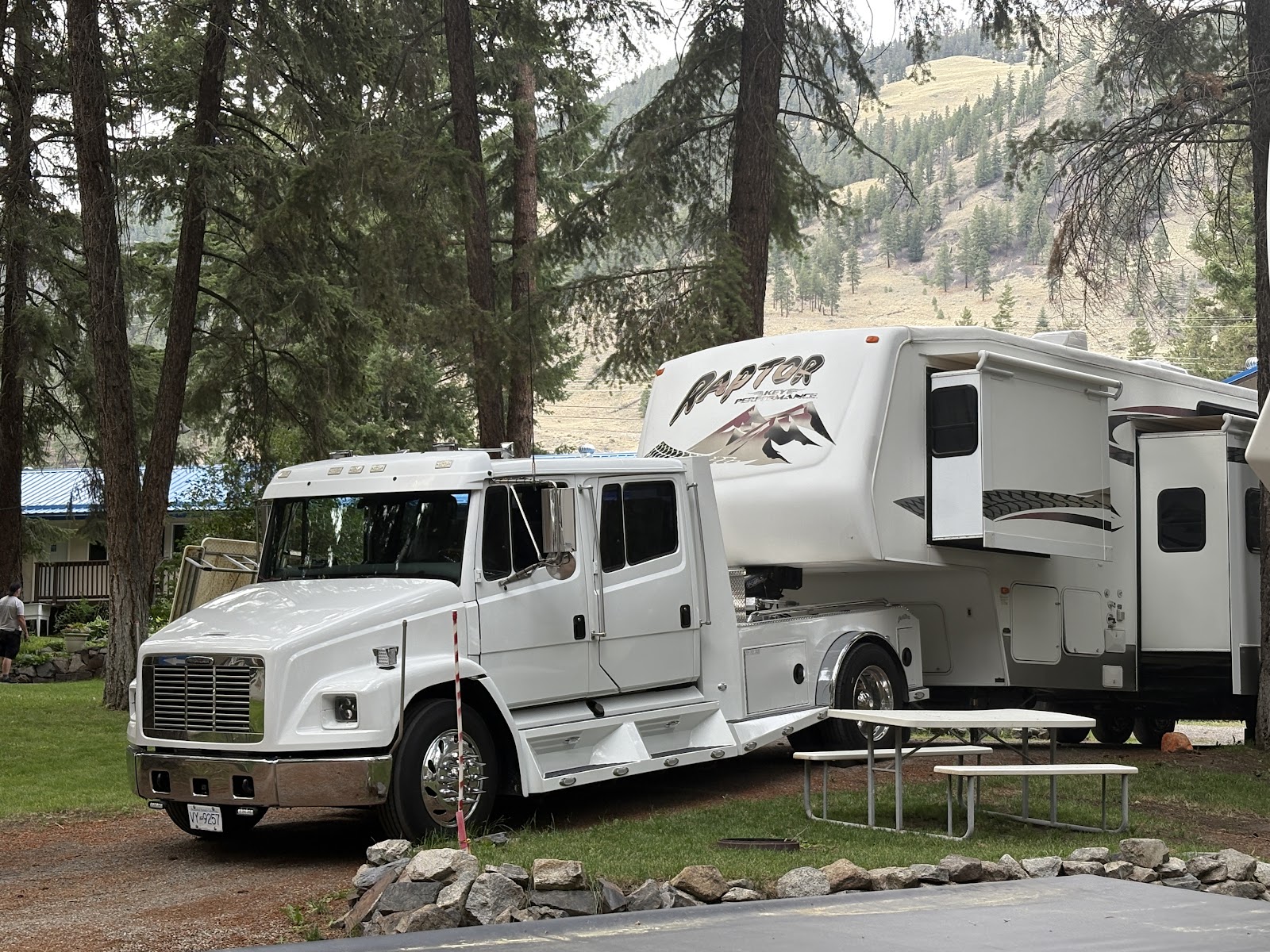
A supersized tow vehicle pulling an enormous 5th wheel travel trailer

Fran by the Similkameen River by our campground

Our rig looks small between these two monster 5th wheel trailers

We travelled a little slower than the 110 k/hr speed limit on these winding steep highways

The perfectly laid out charging site - pull up & no un-hitching (at Manning Park on Crowsnest Highway)

Our campsite in Hope
Hope, BC: History and Highlights
Hope is located at the confluence of the Fraser and Coquihalla Rivers. It was home to the Stó:lō First Nations for 8,000–10,000 years. European settlement began in 1848 when the Hudson’s Bay Company established Fort Hope. The town became a key hub during the Fraser Canyon Gold Rush.
Today, it’s known for its outdoor adventure opportunities and as a filming location for Rambo: First Blood.
Japanese Canadian Internment
Following the 1941 attack on Pearl Harbor, over 22,000 Japanese Canadians—most of them Canadian-born—were forcibly removed from their homes in BC and sent to internment camps. Their properties were confiscated, and after the war, they were forced to either relocate east or be deported to Japan.
Fran’s father, then a Canadian-born teenager, was interned with his siblings and parents in New Denver. After the war, they chose to move to Japan.
Tashme, the largest internment site, was just 19 km west of Hope. It housed over 2,600 people in crude tar-paper shacks. Despite the conditions, it became a functioning community. In 2016, the Sunshine Valley Tashme Museum was established in the original butcher shop. We visited, but unfortunately, it was closed for renovations.


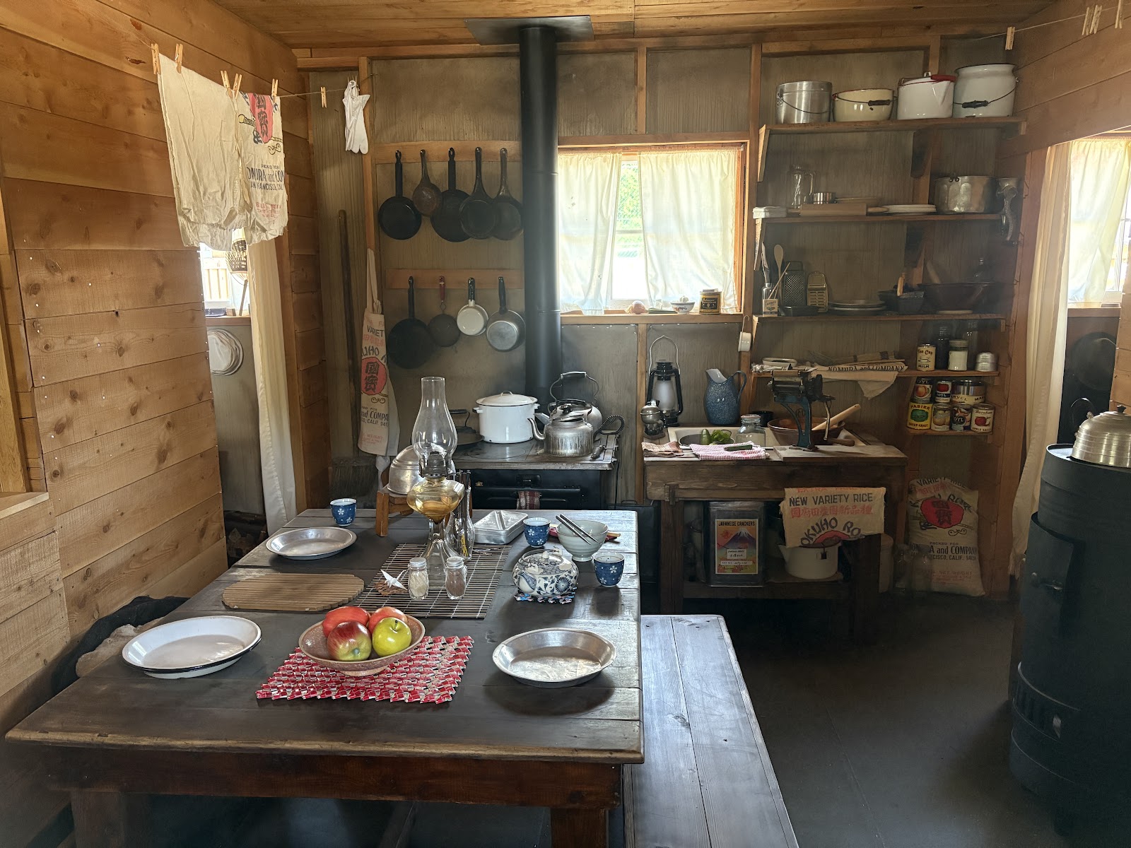
Inside the "tar paper shack"
Hope Slide
On January 9, 1965, a massive rockslide occurred about 15 km from Hope in the Nicolum Valley. It buried a section of Highway 3, killing four people. At the Hope Slide Lookout, we were standing 50 meters above the old highway buried below us. . It remains the second-largest landslide in Canadian history.

Othello Tunnels
We hiked the Othello Tunnels in Coquihalla Canyon Provincial Park—an incredible series of railway tunnels and bridges built in the early 1900s as part of the Kettle Valley Railway. Engineer Andrew McCulloch, a Shakespeare fan, named sites along the line after characters from the Bard’s plays.
The KVR, completed in 1916, was one of the most ambitious engineering projects in Canadian history. It was a vital link connecting the mines of southeastern BC with the coast. Though the railway is no longer in service, the tunnels are a popular hiking trail today. The rugged cliffs, fast-flowing river, and century-old tunnels blew us away.

Following the KVR railway path to the tunnels

Beautiful scenery and river behind us

A photographer's paradise


First of 4 tunnels

River flowing right beside the tunnels


What do you see?

A wonderful hike
After our touring, we enjoyed lunch at a local Japanese restaurant and then toured downtown Hope to see their large collection of "chainsaw carvings".


Wildfire Watch
Just after we arrived in Hope, my sister alerted us to a new wildfire west of town. The RV park manager reassured us that it was a small, active fire being tackled by ground crews and helicopters. Thanks to west winds, we’ve had no smoke.
Tomorrow, we continue west to the Greater Vancouver Area.