Sunday, June 22, 2025

Saskatchewan - Driving through the Land of Living Skies

Saskatchewan – Driving Through the Land of Living Skies


"Welcome to Saskatchewan"


A couple of gofers trying to block our route


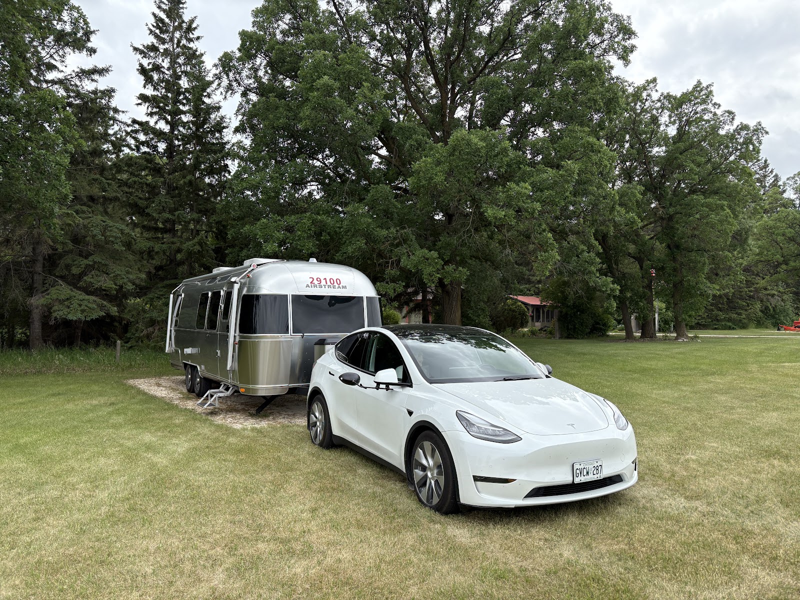
When we were shopping for our trailer, I kept reading that you really need to be handy to own one—there’s always something needing attention. That advice has proven to be absolutely true. Here’s my list of fixes so far:

  • Leak in the hot water tank supply – I rerouted the PEX hose to relieve pressure on the fitting. That seems to have resolved the issue.

  • Inverter adjustment – When we're off-grid, we use our batteries and inverter to power things like the coffee maker and microwave. I noticed the output voltage was a little low. A look at the manual revealed it could be adjusted via DIP switches. I increased it from 115 to 120 volts, which made the coffee maker—and the boss—very happy. While making the adjustment, I also discovered that one of the inverter mounts had come loose and the other had pulled out entirely, so I re-secured them both.

  • Squeaky stabilizer jacks – The four jacks we lower at campsites were making quite a racket, so I sprayed them with white lithium grease. Problem solved.

It's become clear that regular inspections, both inside and out, are essential. Towing a trailer across all sorts of road conditions is hard on the equipment, and things do shake loose.

Here are some fun and fascinating facts about Saskatchewan:

  • Often called Canada’s breadbasket, the province is a major agricultural producer—especially known for wheat, canola, and other grains.

  • It's a global leader in potash and uranium production and has substantial reserves of coal, gold, and rare earth elements.

  • Nicknamed the “Land of Living Skies,” Saskatchewan is renowned for its expansive skies and spectacular sunrises and sunsets.

  • Manitou Lake is a unique saline lake famous for its therapeutic, mineral-rich waters.

  • Southwest Saskatchewan is rich in dinosaur fossils—including the world’s largest Tyrannosaurus rex ever discovered.

  • It’s the birthplace of Canada’s medicare system, having introduced the first universal, publicly funded healthcare program.

  • With 2,000 to 2,500 hours of sunshine annually, it’s the sunniest province in Canada.

  • Saskatchewan doesn’t observe Daylight Saving Time. Instead, it remains on Central Standard Time year-round—aligned with Alberta in the summer and Manitoba in the winter.


Many massive farm operations along our route


Flat and straight Highway #1 (Trans-Canada Highway).


Nice to see some wind generators


Our drive from Brandon, Manitoba to Indian Head, Saskatchewan looked like a simple one. But as we made our way west, our phones lit up with tornado warnings. The next day, Environment & Climate Change Canada reported eight “highly probable” tornadoes in the province.

The upside? A strong tailwind gave us our lowest energy consumption to date—385 Wh/km (for any EV owners following along). We usually cruise at 90 km/h, which makes for a relaxed drive and helps keep our consumption manageable. On the wide-open, lightly travelled Trans-Canada Highway, it’s easy for other vehicles to pass us.

Speaking of EVs, we brought a CCS charging adapter with us and have made good use of it at several FLO chargers. They require a bit more fiddling to start a charge, but they've been reliable and conveniently located.

On Friday, June 20, we celebrated the Summer Solstice in Indian Head. There, the sun rose at 4:42 a.m. and set at 9:10 p.m., giving us 16 hours and 28 minutes of daylight!


Sunrise / Sunset times in Indian Head on June 20th 


Originally, we planned to spend the night at Prairie Bee Meadery, a Harvest Hosts location near Caron. As always, we carefully mapped out our route: distances, charging options, starting and projected State of Charge (SOC), weather, wind forecast, and more. It became clear that we’d need to charge to 100% at Prairie Bee to make it to Swift Current the next day. Unfortunately, a call to the host confirmed charging wasn’t possible on site. So, we pivoted and booked a night at Besant Campground, just west of Moose Jaw.

That’s RV life—flexibility is essential.

With a wet and windy forecast, we made a couple of strategic stops in Regina en route to Besant: a visit to Sunshine Nail Salon, and a quick restock at Costco. By the time we arrived at the campground, the skies were gray, the wind was gusting, and the drizzle had begun. We plugged in the car to charge to 100% and fired up the propane furnace to warm up the trailer.

That night, temperatures dropped to 8°C, while back home in the Greater Toronto Area, a heatwave was in full swing—34°C with a humidex of 45. Something in the middle would be nice for both ends of the country!

The next morning brought more rain and even colder temperatures—down to 6°C as we drove west toward Swift Current. A friend messaged us: “Don’t rush into Alberta—it’s snowing here.” Comforting words!

Fortunately, we made the 139 km trip without issue, arriving at the charger with 10% SOC. The best part? We haven’t had to unhitch the trailer to charge in over two weeks. As we approached the row of six chargers in Swift Current, a driver jumped out of their car and said, “Don’t worry, I’ll move over so you can pull in without unhitching.” How great is that?


An example of the perfect Supercharger - can get at it from both sides making it easy for us


Wide open Saskatchewan sky


It looks like snow!! But it is sodium sulphate, a naturally abundant product around saline lakes. It is a by product of the evaporation of mineral rich waters and it is used in various industrial applications 


This afternoon, we’ll stay warm and dry and catch up on something on Netflix.

Tomorrow, we head into Alberta. Will we need snow tires?

Thursday, June 19, 2025

Westward to Manitoba

Monday, June 16 – Westward to Manitoba

Many friends have asked us about the smoke from wildfires out west. We did encounter a few hazy days along the shores of Lake Superior, but for the most part, the air has been clear. That changed slightly west of Winnipeg, where our Tesla’s air quality index display lit up again—though we still couldn’t smell the smoke or see any visible haze. Still, we’ve both noticed some congestion and a tickle in the throat. There’s rain in the forecast, and we’re hopeful it will help improve the situation.

Leaving Kenora and heading west, the landscape changed dramatically. Gone were the rock cuts and forests—replaced by flat expanses and long, straight roads that barely required a turn of the wheel. We began to see enormous farms stretching to the horizon, dotted with clusters of huge grain elevators and farmhouses sheltered by towering walls of evergreens, planted as windbreaks against the harsh Manitoba winters. The transformation over just 300 kilometres was striking.


Massive farm operations like this were everywhere


Here are some fascinating facts about the great province of Manitoba:

  • The province includes Arctic tundra, boreal forest, and prairie grasslands.

  • Manitoba is home to more than 100,000 lakes, including Lake Winnipeg—one of the largest in the world.

  • Churchill is the most accessible place on earth to view polar bears in the wild—and also a prime location to see the northern lights.

  • Little Limestone Lake, the world’s largest marl lake, changes colour with water temperature.

  • Manitoba is a cultural mosaic, home to vibrant First Nations and Métis communities, Canada’s largest Ukrainian population, and growing Filipino, South Asian, and Black populations.

  • The province hosts the largest concentration of red-sided garter snakes in the world. Each spring, they emerge in massive writhing mating balls—sadly (or not?), we missed that spectacle by a few weeks.

  • Hudson Bay is home to over 25,000 beluga whales, with about 3,000 visiting the Churchill area between mid-June and mid-August.

  • Wapusk National Park in northern Manitoba holds the world’s largest concentration of polar bear dens.

  • Winnipeg boasts the sunniest winter in Canada, with 358 hours of sunshine.

To reach our next stop, we needed a charge at a Tesla Supercharger in Winnipeg. After so much time on peaceful rural highways and small towns, entering the city felt like being dropped into a metropolis—narrow roads, potholes, construction everywhere, and all the usual chaos made worse by towing a 28-foot trailer. It was a huge relief to hit the open road again after the charge.


The streets of Winnipeg - with a 28' trailer attached to us.....


That night, we stayed at our very first Harvest Hosts location: WaterSong Farms, about 40 kilometres northwest of Winnipeg. Owned by Leslie and Rudy Reimer, the farm has been in Leslie’s family for over 60 years. Over the decades, they’ve raised crops, beef, and poultry—but their latest venture is truly remarkable: a state-of-the-art indoor trout farm.

Using a simulated river system, the facility raises steelhead trout in fresh water sourced from a 250-foot-deep aquifer. It’s designed to produce up to 140 metric tonnes of trout annually. Amazingly, 98% of the water is recycled, and the system is completely antibiotic-free. Waste is filtered and used as farm fertilizer. Their trout operation is both Ocean Wise Green Certified and SeaChoice Certified—the gold standard for sustainable seafood.

They also raise two flocks of roasting chickens each year. The whole operation is a model of sustainability, with a clear commitment to protecting the land and supporting the community. We felt fortunate to tour the facilities and hear their story. Leslie and Rudy are now preparing for retirement and will sell the farm and move to Vancouver Island. Before leaving, we picked up some vacuum-packed trout fillets and smoked trout for future meals.

Camping on their beautiful, peaceful farm was a real highlight—so different from a traditional campground and a perfect example of what Harvest Hosts can offer.


Fran with Harvest Hosts - Leslie and Rudy at WaterSong Farms 


Vacu-sealed Steelhead Trout from WaterSong Farms


Our campsite at WaterSong Farms


Wide open landscape around WaterSong Farms


The next day, we made our way to Silver Creek Campground, just east of Brandon, Manitoba. While a few of the secondary roads were rough, once we were back on the Trans-Canada, it was smooth sailing with only one stop needed for charging.

Brandon, known as “Wheat City,” is Manitoba’s second-largest city and a major agricultural hub. It’s home to Brandon University and hosts the Royal Manitoba Winter Fair, the Manitoba Agricultural Exhibition, and various music and arts festivals.

While there, we visited the Commonwealth Air Training Plan Museum—an incredibly well-done tribute to Canada’s role in the British Commonwealth Air Training Plan (BCATP) during WWII. The plan brought together four nations—Canada, Australia, Great Britain, and New Zealand—to train aircrew. At its peak, the BCATP operated 231 sites across Canada, with 107 schools and 184 supporting units. It involved over 10,900 aircraft and more than 104,000 personnel. It’s often called one of the most successful joint military efforts in history.

The museum reminded me of the Warplane Heritage Museum in Hamilton, Ontario which I visited years ago with my father—who served as a flying instructor during the war. He rarely spoke about that time, but during our visit to the Hamilton Warplane Museum, he walked through the hangar, pointing out the planes he had flown and explaining their characteristics. At his funeral, a fellow veteran, Morris Fitzmorris, shared that my dad had trained many airmen—and not one of his students ever crashed. The Air Force, recognizing his skill, kept him in Canada as an instructor throughout the war. As one historian noted, “The flying instructors of the BCATP must be counted among the unsung heroes of the war.”


Pics of the Brandon BCATP


This memorial wall (on the left) names & pays tribute to all those fallen who served in the air and on the ground, overseas and on Canadian Soil. 


This plinth honours the service of those in the trades and professions which supported those who flew - at a ratio of 10 on the ground for each one in the air. They came from all walks of life and their contribution was invaluable, yet it rarely gets the recognition it deserves


After the museum, we took a stroll along Brandon’s lovely Riverbank green space, had a bite of lunch, and then returned to our trailer at Silver Creek.


Brandon Riverbank Park


Purple Martin Sanctuary


It is fair to say both the car and trailer can get quite dirty on long drives like this. Bugs are splattered across the front of the car, the windshield and the front of the trailer. Those who know me won't be surprised that the bugs get cleaned off after each travel day. The car got fully washed at our campsite near Kenora. And yesterday, the trailer got its spa day too.


Tomorrow—onward to Saskatchewan!

Monday, June 16, 2025

Marathon to Kenora

Marathon to Kenora – True North Strong and Free

The drive from Marathon to Sleeping Giant Provincial Park, just outside Thunder Bay, is one of the most beautiful stretches of road in northern Ontario. It winds across the top of Lake Superior, with undulating terrain, dramatic rock cuts, and the rugged beauty of the Canadian Shield. At times, we encountered dense fog—an eerie effect created when cold, damp air off the lake met warmer land air. But as the sun rose higher, the fog lifted and revealed a glorious, blue-sky day.


More fog on the Trans Canada Highway


Sleeping Giant Provincial Park occupies most of a 40+ kilometre-long peninsula that juts dramatically into Lake Superior. From the west side of the peninsula, several viewpoints offer the perfect angle to see the formation that gives the park its name: the Sleeping Giant. According to Ojibway legend, this is Nanabijou, the Spirit of the Deep Water, turned to stone after white men discovered the location of a sacred silver mine (Silver Islet).


Entrance to the park


Nanabijou - The Sleeping Giant


Stephen, Fran and John


The park is stunning. Our campsite was the best we’ve had so far—secluded and immersed in nature. Deer wandered through regularly, following well-worn paths right past our trailer. The weather was just warm enough for a comfortable happy hour outside, and we soaked in the peacefulness.


Fran ready for Happy Hour


Sunset at our Sleeping Giant campsite


The next day, with our friends John and Teresa, we headed out for a full day of sightseeing. Our first stop was the Terry Fox Monument. For those unfamiliar with his remarkable story, here’s a bit of background:

In 1977, at just 18 years old, Terry Fox was diagnosed with bone cancer and had his right leg amputated above the knee. Frustrated by the lack of funding for cancer research, he conceived of the Marathon of Hope—an ambitious plan to run across Canada to raise awareness and $24 million ($1 for every Canadian) for cancer research.

After surgery, chemotherapy, and months of training, Terry began his run on April 12, 1980, in St. John’s, Newfoundland, dipping his artificial leg into the Atlantic Ocean. The early days were tough—harsh weather, small crowds, and modest donations. But that began to change. In Port aux Basques, Newfoundland, the entire town of 10,000 turned out and presented him with a cheque for over $10,000.

About one-third into his journey, Terry’s efforts caught the attention of Isadore Sharp, founder and CEO of Four Seasons Hotels, who had lost a son to cancer. Sharp pledged $2 for every mile Terry ran, offered free hotel accommodations, and convinced over 1,000 other corporations to join the cause. As Terry ran westward, momentum grew. Huge crowds gathered in cities like Montreal, Ottawa, and Toronto, and in every small town in between.

But Terry’s health was deteriorating. On September 1, 1980—just outside Thunder Bay—he was forced to stop running and seek medical attention. He was diagnosed with cancer in his lungs and could not continue. By that point, he had run an astonishing 5,373 kilometres in 143 days and raised $1.7 million. A week later, a national telethon hosted by CTV raised an additional $10.7 million. By April 1981, the total had reached $23 million.

Despite further treatment, Terry passed away on June 21, 1981. Prime Minister Pierre Trudeau spoke in the House of Commons, saying:

“It occurs very rarely in the life of a nation that the courageous spirit of one person unites all people in the celebration of his life and in the mourning of his death... We do not think of him as one who was defeated by misfortune but as one who inspired us with the example of the triumph of the human spirit over adversity.”

Before his passing, Terry agreed to the idea of an annual fundraising run in his name—as long as it was non-competitive and open to everyone. The first Terry Fox Run was held in September 1981, and it has taken place every year since. To date, the Terry Fox Foundation has raised over $900 million for cancer research, funding vital advancements in treatment and prevention. His legacy lives on, not only in fundraising but also in the hearts of Canadians.

The monument, just east of Thunder Bay, is beautifully situated on a hill overlooking the city and Lake Superior. It is moving, powerful, and well worth the visit.


Terry Fox Monument Pics


From there, we continued into Thunder Bay and explored its revitalized waterfront. The city has transformed its former industrial port area into a scenic hub, complete with a marina, boardwalks, green space, restaurants, and condos. We had a delicious lunch at Bight Restaurant—a name taken from the nautical term for a gentle curve in the coastline that forms a large, open bay, perfectly describing Thunder Bay’s shoreline.


Thunder Bay Marina


The Bight Restaurant

T


Thunder Bay Waterfront


Our afternoon continued with a short drive west to Kakabeka Falls in Kakabeka Falls Provincial Park. Often called the “Niagara of the North,” these falls are the second-highest in Ontario after Niagara Falls. With a 130-foot drop on the Kaministiquia River and an impressive volume of rushing water, they are dramatic and photogenic—definitely worth the visit.


Niagara of the north


Kaministiquia River


We wrapped up the day with a few errands in Thunder Bay, then celebrated John and Teresa’s 40th wedding anniversary with dinner at Kelsey’s, before heading back to our peaceful site at Sleeping Giant


40th Anniversary Dinner


Enjoying a Sleeping Giant Beer


Thursday, June 12 – Onward to Kenora

We left Sleeping Giant Provincial Park and began our journey west toward Kenora. Along the way, we were surprised to discover that Ontario spans two time zones. Just west of Thunder Bay, you cross from Eastern to Central Time—a fun bit of trivia we hadn’t realized until the time on our phones suddenly changed.

Our first stop en route to Kenora was Sandbar Lake Provincial Park, near Ignace. Then, on Saturday, June 14, we continued on to The Willows Campground, just outside Kenora. EVs are still relatively rare in this part of Ontario, so it was encouraging to see that every Tesla Supercharger we encountered had six 250 kW stalls—ample capacity and no waiting. That meant we didn’t need to unhitch the trailer on either travel day, which is always a welcome bonus.

With each leg of the trip, we’re gaining confidence managing our limited range while towing our 8,000-pound trailer. We keep a close eye on weather and elevation changes, both of which can significantly affect our efficiency. That said, we know there are still a few upcoming stretches that will really push our limits.

Kenora itself has a fascinating history. Originally a key Ojibway fur trade route and transportation hub, a Hudson’s Bay Company Post was established on Old Fort Island in 1836. It was relocated to the mainland in 1861 and named Rat Portage. The town later became the centre of a prolonged boundary dispute between Ontario and Manitoba, with both provinces claiming jurisdiction.

Rat Portage was incorporated as a Manitoba town in 1882, but the dispute was ultimately resolved in Ontario’s favour. In 1905, the name was changed to “Kenora,” a blend of the first two letters of Keewatin, Norman, and Rat Portage. In 2001, Kenora, Keewatin, Norman, and Jaffray Melick were amalgamated into the modern City of Kenora.

Today, Kenora is a vibrant regional centre on the shores of Lake of the Woods, known for its natural beauty, strong tourism industry, and roles in forestry, mining, and fishing.

We spent Father's Day Sunday enjoying wonderful phone and FaceTime calls from family, running a few errands to Canadian Tire and the grocery store, and treating ourselves to lunch at Boston Pizza. Later, we explored Kenora’s scenic waterfront. The weather was perfect, making it easy to relax with a refreshing gin and tonic under the shade trees beside our trailer.


Happy Hour at The Willows Campground


Father's Day Lunch


A truck pulling a 5th wheel trailer pulling a boat!!