Sunday, July 31, 2016

BOUCTOUCHE, SUMMERSIDE & CHARLOTTETOWN - July 23 - 30, 2016


Here is our route covered by this blog. The map, lines
and labels are from our brother in law Manny from
the Philippines (thanks Manny)


After that thunderstorm and high winds on Bay du Vin, near Miramichi, we had a bad night of wave slapping on the hull and were up at 0530 feeling rather worn out, but eager to get underway to our next destination, Bouctouche (pronounced - Buck-too-shhh), New Brunswick. It was a long, 67 mile run, but we were looking forward to meeting up with Dave and Judy from Sir Tugley Blue, whom we’d been separated from since June 21st. For us, the run out to Point Escuminac and south to Bouctouche was a very smooth one, but for Sir Tugley Blue, the first half of their run from Shippigan to Bouctouche was much rougher and uncomfortable. 

Bouctouche is a small village of 2,400 on the Bouctouche River. The name comes from the Mi’Kmaq word meaning “Great Little Harbour”. It was first settled by Acadians in 1785 and in the 19th century by Irish and Scottish immigrants. Today, 89% of the population are French speaking. Bouctouche is best known for its shoreline sand dunes formed by centuries of wind and stormy seas. The sand dunes have almost closed off the entrance to the bay, which is now 1.8 kilometres wide and still shrinking. 

Today, New Brunswick and the Irving family go hand in glove. Kenneth Colin Irving (Mar 14, 1899 - Dec 13, 1992) was one of Canada’s foremost entrepreneurs of the 20th century and was ranked as one of the world’s leading industrialists. K. C. Irving’s businesses began with a family sawmill in Bouctouche, NB.The Irving conglomerate of private companies now includes shipyards, oil exploration, refining and retailing, various food processing operations, media, hardware, building supplies, transportation, engineering and construction companies and more. All these companies are vertically integrated with each Irving company purchasing the services of other Irving companies keeping the profits wholly within the conglomerate. 

Reportedly, a majority of New Brunswicker’s work either directly or indirectly for the Irving family. The Irving family have almost a complete monopoly in print media in New Brunswick. Their level of influence is of potential concern, but on the plus side, they have invested considerable funds into environmental controls and alternative energy for its operations. The Irving family and all their companies are actively supporting Canada’s ratification of goals to reduce the country’s carbon footprint. In the 2011 list of Canadians by net worth, the combined Irving family ranked third in Canada at $8.07 billion. 

K. C. Irving and his wife were first buried in Bermuda. Later, in 2004, their bodies were exhumed and moved to the Scottish-style chapel built on the Jean Irving Plantation in Bouctouche, NB. This chapel is modelled after one in Scotland and master craftsmen were brought in to construct it. As the photos below show, it is a stunningly beautiful structure completed with great care and skill. The Jean Irving Plantation was created under the direction of Jean Irving over a 35 year period. It has over 5,000 trees, all indigenous to New Brunswick. The plantation also includes an Elizabethan garden, ponds, picnic tables, benches and walking paths for visitors to wander and enjoy the setting.

Beautiful Chapel built by Irving family


Chapel interior - ceiling like the inside of
a wooden ship


The Irving family have also taken a special interest in preserving the Bouctouche sand dunes so future generations may enjoy this special area. They installed boardwalks through the dunes so visitors can enjoy them without damaging the delicate marram grass that protects the dunes from erosion. They also installed an interpretation centre (Irving Eco Centre) for visitors to learn about the dunes history and the over 2,000 year time frame it took for their evolution into the present state. We took a walk along the lovely board walk and also walked the beach barefoot, enjoying wading in the fairly warm waters of Northumberland Straight. Later, we visited Le Pays De La Sagouine, a reproduction of a prohibition-era fishing village where you can discover Acadian culture through a group of unique characters, theatre, music, comedy, dance and cuisine on a small island in the town of Bouctouche. We enjoyed some lively music and dinner there, as the sun set. A perfect end to a great day.

Bouctouche sand dunes, boardwalk and beach


Fran & Stephen on boardwalk over dunes


Le Pays De La Sagouine (Acadian village)


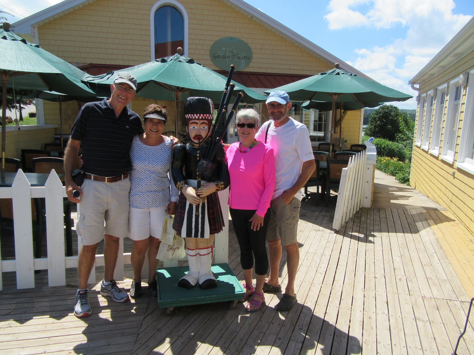
Monday, July 25, 2016. Another week, another province. Today, we headed off to Prince Edward Island, crossing the famous Northumberland Straight. Again, we were blessed with good weather and had a smooth ~ 42 mile crossing, tying up at Silver Fox Yacht Club in Summerside, PEI. After getting settled, we headed off for an evening performance at the College of Piping & Celtic Performing Arts of Canada. The show was called “Highland Storm” where we were entertained by a wide range of Celtic music (bagpipes, guitar, drums, harp and more) and dance (both traditional and more modern highland dancing), performed by faculty, students and alumni. During intermission, we dined on strawberry shortcake with whipped cream, a favourite of mine - mmmmmmm!!!! All in all, it was a real treat and a great introduction to PEI.

Pipers & drummers in "Highland Storm" performance


Over the next two days, our crews of four boats rented two vehicles and we toured as much of the PEI countryside as we could. On Tuesday July 26th, we toured much of the North Coastal Route all the way out to North Cape and back, in a large circle. Everywhere we went, the homes, properties and farms were all impressively well maintained, neat and tidy. Every second farm seemed to have a lobster boat up on blocks after the conclusion of the recent fishing season, cleaned up and ready for 2017. We toured Mount Carmel Catholic Church, bought fresh cod from a fishery on the north west coast, saw the wind farm on the North Cape, had a seafood lunch (Lightkeeper’s Platter) at the Wind & Reef Seafood Restaurant, had beers at the West Point Harbour “The Catch Kitchen & Bar” and more… The photo of our Lightkeeper’s platter includes: two bowls of chowder, one lobster, raw oysters, scallops, shrimp, haddock, 2 pounds of mussels, Caesar salad, green & yellow beans & carrots and rice. It was awesome!

Lobster boat on blocks for the winter


Commercial harbour - lobster traps all stored for next year


Fran & Judy with a local fisherman


Mmmm - fresh oysters


Lightkeeper's Platter - wow, what a meal we shared


North Cape red cliffs & windmill farm


On Wednesday July 27th, we covered a fair part of the Central Coastal Drive in PEI. We enjoyed
  • more rolling countryside
  • many small villages and towns
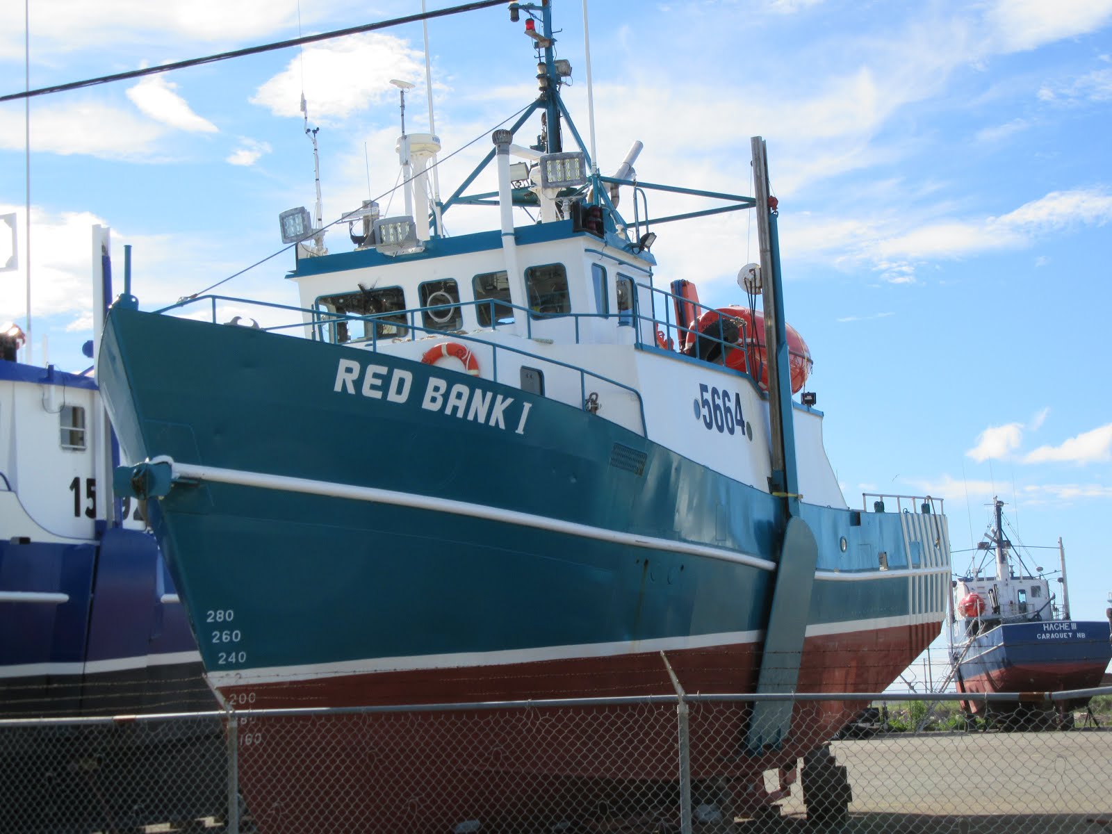
  • several small commercial harbours with anywhere from 4 to 20 lobster boats
  • a light lunch at New Glasgow’s PEI Preserves Restaurant, which included scones and local jams
  • a walk through the beautiful, pastoral Garden of Hope next to the restaurant 
  • walked around Victoria by the Sea, a lovely village on Northumberland Straight
  • and much, much more
One of many beautiful churches we saw


Potatoes, potatoes everywhere!


Scenic small commercial harbour with farms in the
background


Stephen, Fran, Judy & Dave with a local piper


The crew of 4 boats having coffee in Victoria by the Sea

On Thursday, July 28th, we departed Summerland for Charlottetown, the Capital of PEI. Prince Edward Island is Canada’s smallest province of only 5,660 square kilometres and a population of approximately 147,000. It has a special place in Canada’s history as it is called “the Birthplace of Confederation”. Back in 1864, Charlottetown hosted the “Charlottetown Conference” where the maritime colonies of Nova Scotia, New Brunswick, Newfoundland and PEI were to discuss a maritime union at the urging of Britain, so they could become more economically independent from Britain (cost Britain less) and have greater military power for the region in the hopes of preventing any military intervention from America. The Province of Canada (comprising today’s Ontario & Quebec) heard about the planned conference and asked to join in and expand the agenda to discuss a union that would also include them. In September 1864 the conference was held and the delegates from all these regions (both government & opposition representatives) had lengthy meetings and social gatherings and in the end, they reached a level of understanding that created sufficient momentum that by July 1, 1867 the Dominion of Canada was formed. Initially, it included only four provinces (Ontario, Quebec, Nova Scotia and New Brunswick) with the remaining six provinces and three territories joining at later dates. 

Prince Edward Island joined Canada as a province in 1873 after negotiating a Federal Government commitment to provide “…efficient steam service for conveyance of mail and passengers between the island and mainland, winter and summer…”. 

Today, we were very excited to travel by boat from Summerside to Charlottetown as we’d have the opportunity to pass underneath the Confederation Bridge. While PEI enjoyed various forms of ferry service to and from the mainland with growing federal subsidies over the decades, the cost kept growing, prompting regular discussions about building a fixed link to the island. Finally, a proposal in the mid 1980’s resulted in the current bridge being built. However, there were conflicting views in PEI about the project resulting in court challenges, lengthy environmental impact studies and concerns from “Friends of the Island” who felt the fixed link would forever change the unique character of the island for the worse. A constitutional amendment was also required to deal with the change in service from ferry to bridge and the charging of tolls. 

Construction of the bridge took place from 1993 to 1997. All components of the bridge were built in purpose built staging yards at Amherst Head, New Brunswick including pier bases, ice shields, main spans and drop-in spans. Extra durable concrete and rebar was used in all the pre-cast components and the bridge was designed to last over 100 years. A Dutch built, heavy lift catamaran was rented to move the bridge components out into Northumberland Straight and put each one in place. The project required over 5,000 workers including engineers, surveyors and managers. 

The two lane toll bridge is 12.9 kilometres long and cost $1.3 billion. The multi-span beam bridge with post-tensioned concrete box girders has 44 main piers, each 250 meters apart and 18 smaller piers. It has a speed limit of 80 kilometres per hour. A car toll is $46 in 2016 for the round trip. Pre opening of the bridge, there were about 740,000 visitors to the island per year. In 1997, the year it opened, there were 1,200,000 visitors, but this has dropped back to 900,000 visitors per year. The number of overnight guests visiting the island has dropped as more people can now make day trips to PEI. Agricultural exports from the island increased significantly after the bridge opened. Big box stores have opened on the island providing more retail products to residents than ever before, but inevitably, it resulted in closing of many family owned retail outlets. 


Passing under the bridge was a huge thrill. It is a massive and beautiful structure and our pictures do not do justice to the marvel of the engineering of this bridge. 

Passing under Confederation Bridge (an engineering marvel)

After arriving in Charlottetown, we were picked up by a university friend of Stephen and had a wonderful reunion at the home of Ron, Hillis and their daughter Heather. Stephen had last seen them in about 1986 and Fran had never met them. We had the most wonderful time together reminiscing about previous adventures including a 4 month backpacking trip Ron & Stephen did around Europe in 1973. The next day, Stephen and Ron spent the day together hiking through the Prince Edward Island National Park of Greenwich, PEI including visiting the interpretation centre covering the eco sensitive dunes on PEI’s north shore, followed by a fish lunch in Greenwich. Later that evening, Ron and Hillis joined us for a tour of Tug’n in the Charlottetown Marina and dessert on board.

PEI National Park of Greenwich


Boardwalk through dunes and ponds - PEI National Park


On our third day in Charlottetown, Fran and I spend the day exploring the downtown including a visit to the Saturday Farmer’s Market, St. Dustan’s Basilica, Victoria Row (a pedestrian street), Province House (where the Fathers of Confederation met for the Charlottetown Conference of 1864), Cow’s Dairy (reputedly the best premium ice cream in the world) and more.

Province House


Stephen chatting with two Fathers of Confederation
with St. Dusdan's Basilica in the background


Shops on Victoria Row, Charlottetown


PEI, its cities, its countryside, its sandy dunes and beaches on its north shore, its red cliffs on its west and south shores, its neat and tidy farms and its many commercial harbours is exceptionally beautiful to see, taste and experience. The people are so very friendly. There were tourists from all around the world enjoying it with us. Licence plates on the cars were from all over Canada and the US. PEI really is a special part of Canada and it too should be on everyone’s bucket list. PEI has enormous charm and beauty and we loved every moment of our six day visit. However, PEI would not be our first choice for a winter residence. You’d have to have a special love of winter, snow and wind for that.

Thank you - Prince Edward Island!


Sunday, July 24, 2016

L'ANSE-A-BEAUFILS, SHIPPAGAN & MIRIMICHI - July 18 - 21, 2016

Where we've been in the last few weeks (St. Lawrence)


Gaspe

Looking ahead at the wind forecast we knew we needed to cross Bay of Chaleur on Monday to beat the high winds forecast for the following two days. We were up at 0500 and underway by 0600 to ensure we’d arrive at our next destination of Shippagan, New Brunswick, approximately 48 nautical miles away, well ahead of the high winds. 

It was a lovely clear sky with light winds, but there was plenty of low lying fog to deal with. No more than a half mile from leaving the dock our three boats were enveloped in a dense fog, where much of the time we had less than 200 feet of visibility. Thankfully this area had light boat traffic and we all had good radar equipment to not only track each other, but keep watch for any other boats. We all use autopilot and when travelling through fog, you spend most of your time staring at the radar screen watching for any new blips that might signal another boat. Wings and Encore also had AIS (Automatic Identification System) that picks up a signal on their screen from any other AIS registered boats, which regularly proved really helpful. Finally, our VHF radio has a fog signal that it broadcasts every two minutes through our loud hailer that may also alert other vessels in the area to our presence. All worked well and with about 9 miles remaining on our route, the fog lifted and New Brunswick came into sight. 

We had entered Quebec June 14th and finished up July 18th, just a day short of 5 weeks. That will be the longest stay in any province or state for the duration of this trip, which is a reflection of the size of Quebec and how much shoreline Quebec has. We truly had a spectacular time in Quebec and we are very grateful to all the wonderful Quebecers we met who were so very helpful and welcoming and eager to learn about our cruising plans. Merci beaucoup…

New Brunswick is one of Canada’s three Maritime provinces and it is the only constitutionally bilingual (English-French) province. It was created as a result of the partitioning of the British Colony of Nova Scotia in 1784. While the majority of the province is English speaking, there is a large Francophone minority (33%) of Acadian origin. Once again, Jacques Cartier is the first known European explorer to visit this area in 1534 and who discovered and named the Bay of Chaleur. The province shares boarders with the Maine, Quebec and Nova Scotia. 

Shippagan was founded in 1790 by the Duguay family from Quebec. Acadian settlers later joined them as its location was ideal for exporting timber from further inland as well as for fishing. Over the years, ship building, lumber exports, peat moss processing and fishing were mainstays of the local economy. Today, fishing and peat moss continue to play an important role. 

Shippagan Marina


There is a large commercial fishing harbour in Shippagan, which we toured and found very impressive. Fishing for scallops, snow crab, oysters, lobster, muscles, salmon, herring and other species is tightly controlled by the province to ensure its long term sustainability and viability. The season is very short (about two months) and quotas are tightly monitored. Their 2016 season had just finished about 10 days before we arrived and it was followed by Shippagan’s one week long New Brunswick Fisheries and Aquaculture Festival to celebrate the sea and its riches and the importance of fishing to Shippagan. As you’ll see from the photos below, the bulk of the fishing fleet is already hauled out and waiting for the spring of 2017. We also visited a local hardware store that caters to the fishing industry and were impressed by the extent of their inventory of heavy duty equipment for the fishing trawlers and the folks who work on those boats.

Commercial Harbour - fishing trawlers hauled out


Right next to the marina is Shippagan’s outstanding Aquarium, where they have over 100 species of fish and invertebrates on display in large tanks. They have well designed interactive displays to help visitors understand the various types of fishing in the area including:
  • Inshore Fishing - day trips up to 8 kilometres from shore for lobster, scallop dredging, longlines, gill nets and hand lines
  • Mid Shore Fishing - trips up to 8 days for crab, longlines, purse seine, ground fish trawlers and shrimp bottom trawlers 
  • Offshore Fishing - trips up to a month for pelagic trawling to catch a variety of fish including redfish, mackerel, flounder, shark etc

They also had a great film on sea life in the Gulf of St. Lawrence.

One of the Acquarium tanks


Very rare blue lobster


A long time, important product from the fishing industry has been salted cod. Cod was plentiful and cheap and it became a food for the poor. Our forebears’ needed a way to eat fish year round and salting became the primary means to preserve the catch. Salt cod goes back to the Vikings. It also shares a history with the slave trade as it was a food preserved for the long ship journeys from Africa to the Americas where it also became a food for the slaves on southern plantations.

We spent three nights at Shippagan, and as forecast, the wind blew 25 to 32 knots most of our stay. Over time, we added more fenders and dock lines to keep the boat secure and regularly checked and tightened our lines. Finally, on Wednesday night, the wind began to moderate and at our happy hour we were finally ready to plan our next leg to Miramichi. 

The city of Miramichi was formed in 1995 through the forced amalgamation of two towns, Newcastle & Chatham, plus several smaller communities. Well prior to European settlement, the Miramichi region was home to members of the Mi’kmaq First Nation. Following European discovery of the Americas, the Miramichi area became part of the French colony of Acadia. The French and Indian War erupted in 1754 and many Acadian homes were destroyed by the British and the Acadian refugees lives were terribly disrupted over the next 30 years. Most ended up in Quebec City, but by 1785 a considerable Acadian community was re-established in the Miramichi area. In the late 1700’s and through the 1800’s there were waves of immigration of Scottish and Irish immigrants to the Mirimichi area. 

Today, 89% of the population speak English only and 8% French only. Miramichi bills itself as “Canada’s Irish Capital” as it is one of Canada’s most Irish cities and it is home to an annual Irish festival. Miramichi’s economy is primarily focused on mining, fishing and forestry. Although closure of several wood mills caused many residents to migrate west to join in the shale gas boom in Alberta. Unfortunately 2015/16 has of course not been kind to Alberta residents. 

After a 40 nautical mile run to reach Mirimichi Bay, we still had another 25 mile run to get through Mirimichi Inner Bay and up the Mirimichi River to the town. On our way up the river, we were hopeful of getting a holding tank pump out at one of the two marinas. It was low tide and the first marina told us not to come in as their water depth was marginal. The second marina encouraged us to come in. It was small and had a very narrow channel to enter and we churned up all kinds of mud, but we did get our pump out and then backed all the way out of the channel.  

Finally, we arrived at the town of Miramichi at their Ritchie Wharf and were surprised to find signs saying “no overnight docking”. Thankfully, Azade Hache, Captain of the Miramichi Boat Tours, called city hall on our behalf and got permission for us to tie up for the night. Richie Wharf  is the site of Miramichi’s former thriving shipbuilding industry and today, the park has a shipbuilding theme and a nautical themed playground for children. Later, we were visited by Jeff and Paul from Miramichi’s City Hall to welcome us and confirm we were ok to dock there for the night. They outlined plans the city has to expand their visitor dock space to encourage more boat traffic. The docking for us was free, but they did suggest we might spend some money in town during our visit. 

The Ritchie Wharf park is extremely well used by the community. Through the summer there free concerts nightly. Over 200 locals and visitors attended the country music concert the night we were there and the deck for dancing was being well used. There were boutiques, a restaurant, the all important ice cream shop and a lovely display of old photographs of historic Miramichi. For me, the best ones were the tall sailing ships from Europe and South Africa tied up at Ritchie Wharf and loading up on lumber for their return trip. For others, maybe it is the photo of King George VI and Queen Elizabeth’s visit to Mirimichi. 

Miramichi's nautical themed waterfront

Miramichi's waterfront boutiques

Tug'n & Encore at Ritchie Wharf

The tidal water makes it all the way up the Miramichi River to the town with a 4’ plus tidal range. When the flood tide comes in against the prevailing south west wind, the wave action makes the sections of dock move up and down like a wave. This, combined with boat traffic made the docks extremely noisy and somewhat uncomfortable. So, this was clearly going to be a one night stay. In the morning, we visited the town and did some grocery shopping. A local men’s wear shop had a great sale on and Bob, Lee and I all found some clothes and Fran got a haircut. So, all in all, we felt we’d lived up to our commitment to spend some money in town. 

Bob & Fran at Ritchie Wharf

As our next port of call was almost 90 nautical miles away, we decided we’d depart Miramichi that afternoon to get a head start and get out of the river and anchor in Bay du Vin, about 20 miles down stream and almost out in to Miramichi Bay. We rode the ebb tide out, giving us a lift of about 1.5 knots and anchored in a rather shallow area, forcing us to be 3/4 of a mile from shore. It was lovely to be anchored out and we enjoyed happy hour in our cockpit. We knew the high temperatures and humidity created the opportunity for a thunderstorm and indeed it happened. We had an hour’s warning watching dark clouds build and hearing the rumble of thunder. Then at 2000 hours, it hit with lots of thunder and lightening all around, heavy rain and winds in the mid 30 knot range with gusts up to 46 knots. Before long, we had 3 to 4 foot waves making for a very dramatic scene. We kept in touch with the other two boats on VHF radio for the duration of the worst of the storm, which lasted about 25 minutes. Gradually, the wind settled down and within an hour, the thunder was moving off in the distance. All our anchors held well and we were greatly relieved when the storm passed.

Wind blowing 35 knots out our pilot house window

Tuesday, July 19, 2016

GASPE, L’ANSE-A-BEAUFILS, PERCÉ & ILES DE BONAVENTURE - July 14 to 17, 2016

We spent a lovely three days in Gaspé enjoying the town and waiting out some unfavourable (25 to 35 knot) winds. We took multiple walks in town, along the waterside board walk, up to the Musee du Gaspé and further up to the ice cream store with its magnificent views of Baie Gaspé. On the dock one day, a woman named Tracy stopped me as I had a Mimico Cruising Club sweater on. It turns out she and her husband Donald had purchased a sailboat named Jazz V, owned by our good friends Warren and Shirl. That coincidence is on top of the fact that the owners of Encore used to own a sailboat named Duck Soup they bought from another Mimico member named Sid. What a small and wonderful world this is.

Saturday, July 16th rolled around and with its light wind forecast and clear sky we continued with our adventure. Today we’d pass Percé Rock, Ile Bonaventure and end up in L’Anse-a-Beaufils for the night.

Because we’d seen so many whales and porpoises on our way in Baie Gaspe, we were anticipating another round of whale sightings. It turns out we didn’t see one whale or porpoise. Who knew it could differ so much from one day to the next. As we exited the bay, the famed Percé Rock and Bonaventure Island came into focus. Percé Rock is an immense limestone rock dated more than 400 million years old. Fossils in this area show a variety of animal and plant communities from both terrestrial and marine habitats from the Devonian period. Originally Percé Rock was attached to the main land. When Jacques Cartier first arrived here in 1534 he reported three openings / arches in the rock. In time, two of the arches disappeared with the last one collapsing on June 17, 1845 leaving a separated pillar. The openings were cut through by sea waves. The current arch is about 49 feet high and a small boat can pass through the arch during high tide. Percé Rock of course is a major tourist attraction in Quebec with magnificent views from both the small village of Percé and nearby Bonaventure Island. 

We took our time getting close to Percé Rock and taking far to many pictures and marvelling at the immensity of it. The rock is estimated to weigh 500 million tons and about 400 tons of rock erode each year, such that it will disappear within 16,000 years.

Percé Rock


Tug'n in front of Percé Rock

Next, we headed a little more south east and circumnavigated Ile Bonaventure. This island was an early seasonal fishing port in New France. Settlers from southern Ireland came here in the early 1790’s and later, Peter Du Val, from New Jersey set up a fishery which lasted 25 years, closing in 1845. In 1919, Ile Bonaventure became a bird sanctuary as a result of the Migratory Bird Convention reached between Canada and the United States in 1916. The Province of Quebec expropriated the island in 1971 and later, grouped it with Perce Rock to form Parc National de L’ile-Bonaventure-et-du-Rocher-Percé. Ile Bonaventure is now one of the largest and most accessible bird sanctuaries in the world with more than 289,000 birds. It is a major tourist attractions with boat and island tours from May to October. 

There are 293 different species of birds recorded as visiting, migrating to, or living on Ile Bonaventure. The most common bird is the northern gannet with about 52,000 nesting pairs. Other species include the black-legged kittiwake, the common murre, terns, black guillemots, auks, herring gulls, Atlantic puffins and many more. It was hard to properly capture the vast numbers of birds we saw, but it was an amazing sight to see. 

An hour later we pulled into the charming harbour in the tiny village of L’Anse-A-Beaufils. This is a former cod fishing port that has gone through a metamorphosis to its current state. When the cod fishery died, 49 residents of the village bought the fish plant and converted it to an art gallery, theatre and restaurant. Tour boats also take tourists out to see Percé Rock and Ile Bonaventure. A micro brewery now occupies another piece by the harbour that previously housed more of the fishery operations. You’ve never met a more friendly and pleasant group of people who are clearly very motivated to make their businesses a success. Fran and I couldn’t resist sitting down at the restaurant for a bowl of their scrumptious Fisherman’s Soup with fresh cod and salmon. Later, we did a hike along the “river trail” by the Riviera du Portage through a beautiful forest. 

L'Anse-a-Beaufils 

Entertaining boat designs

Beautiful hike at L'Anse-a-Beaufils


At our happy hour on the dock, we met up with Roger and Chris off a 52’ Bayliner named Miss Utah (named after their former dog whose ashes travel on board with them in a small box). They had spent the day on Iles Bonaventure hiking the trails to see the bird sanctuary and their enthusiasm convinced us to stay another day.

Sunday July 17, 2016
We were up at 0600 and over to the commercial dock by 0715 to hitch a ride with the tour boat operators over to the village of Percé from where we’d buy a ticket for the tour of Iles Bonaventure. It was a bright sunny day with a light breeze and a very comfortable temperature. Bob and Jan off Wings came along and spent the day in Percé as Bob’s hip and use of crutches wouldn’t let him do the hike. Lee and Barbara from Encore joined us on the hike. The tour boat first took us around Iles Bonaventure where we got a good view of the grey seals that enjoy the rocky shoreline. Then we were dropped off at a dock at the island and after a brief explanation of the trails, we set out across the island. We walked through a beautiful forest on a well built trail & boardwalk and as we approached the east shore, you could hear the calls of the northern gannets from quite a distance. The size of the breeding ground and numbers of birds was overwhelming.

Northern Gannets are seabirds. They nest on offshore islands and inaccessible cliffs and eat fish and squid. They plunge dive from a height of up to 130 feet, vertically into the ocean at speeds up to 62 miles per hour. Most dives are shallow, but they can go as deep as 72 feet below the surface. Northern Gannets breed in only six well established colonies in the Gulf of St. Lawrence, Newfoundland and North Atlantic. The oldest recorded Northern Gannet was over 26 years old. Their nests are made from a compacted pile of mud, seaweed, grass, flotsam and feathers cemented together with excreta. Each nest and its perimeter is about 18” square. Another bird dare not enter that space or they will be subject to a severe attack by the occupying bird. 

Our 10.8 kilometre hike around the island gave us views of three enormous colonies of Northern Gannets. In those areas where the wind was offshore, there was next to no smell. In other areas the smell was a little more ripe. You really have to see the numbers of birds to believe it. In some locations we were a mere three feet away from the nesting birds; it was quite an experience. At the end of our hike, we toured one of the well preserved former residences of the island. It contained a short exposé with graphic memories of young boys who worked in the harsh conditions in the local fish processing plant. It is fair to say no parent or child would ever want to work in such conditions today. 

Northern Gannets at Iles Bonaventure

Grey seals


Size of cod fish in the old days


We returned to Percé for a late lunch with Bob and Jan and then hitched a ride back to L’Anse-a-Beaufils as the clouds rolled in, the temperature dropped and the rain began. We enjoyed a hot shower on the boat and a quiet evening on board with the heater going.